 |
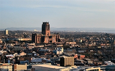 |
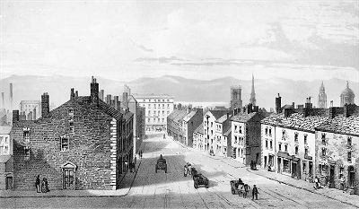
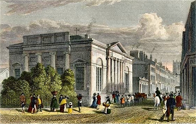
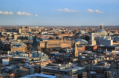
| Two
views over the Town Centre from the West Tower |
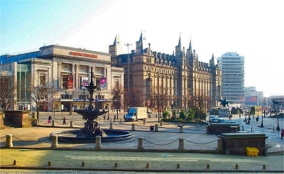 |
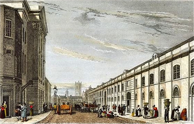
| Lime
Street from the Walker Art Gallery |
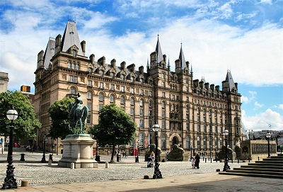 |
| The
North-Western Hotel |
 |
| Lime
Street Station |
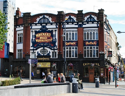 |
| The
Crown Hotel |
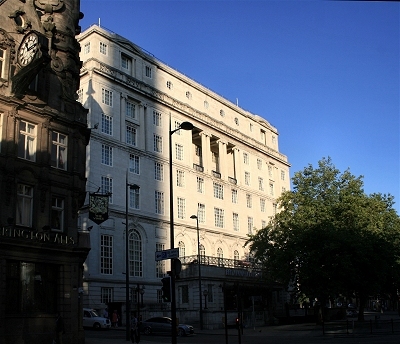 |
| The
Adelphi Hotel |
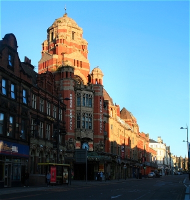 |
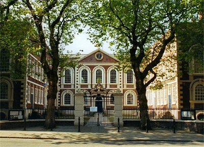
| Grand
Central |
|
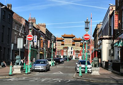
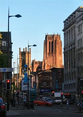
| Lime Street and Renshaw
Street |
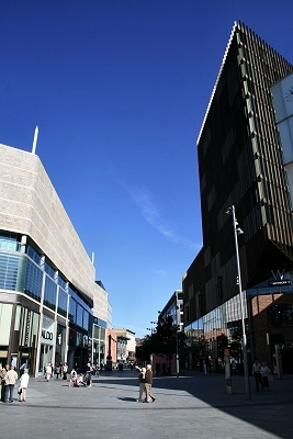
| Visitors arriving in
Liverpool at the magnificent Lime Street Station
will immediately be confronted by the contrasts
that characterise the town centre today. From the
station steps, a glance to the right reveals St.
George's Hall, some of the Museum Area buildings
and the grandiose North-Western Hotel, a vista
that immediately stamps Livepool as a world class
city. Opposite, however, are a monstrous animated
advertising hoarding that masks but fails to
improve a brutalist multistorey car park, the
overwhelmingly dull aspect of the St. John's
Centre complex and the dominating but equally
mind-numbing Radio City Tower. Moreover the
continuation of Lime Street to the south, apart
from being book-ended by two magnificent pubs,
has been one of the most run-down streets in the
centre. At the time of writing this area, at
least, is undergoing a major redevelopment. |
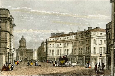
| Lime Street
is probably Liverpool's most famous street by
name. It begins at the eastern end of William
Brown Street and a particularly fine view is from
the steps of the Walker Art Gallery towards the
Steble Fountain, the Empire Theatre and the
North-Western Hotel. The photo was taken some
years ago and the monstrous tower block on the
right has since been put out of its misery. |
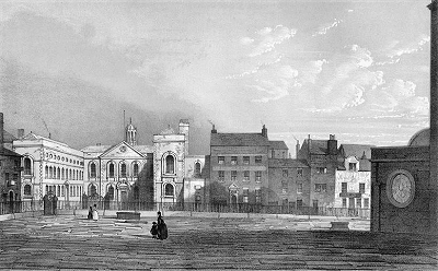
| The
North Western Hotel: Alfred Waterhouse's
1871 North Western Hotel was originally the
station hotel and now provides student
accommodation for John Moores University.
Recently the public area at the northern end has
had an expensive and tasteful refurbishment by
Weatherspoon's and provides a flavour of the
grandeur of the past. |
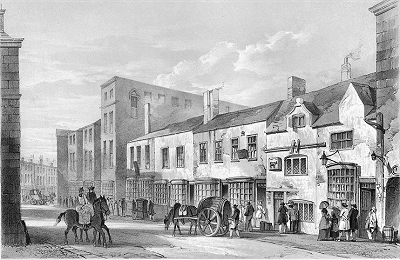
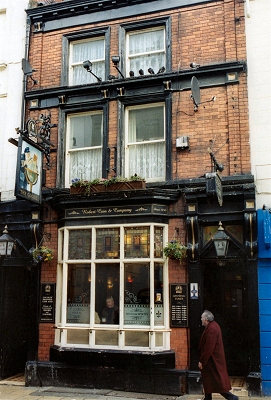
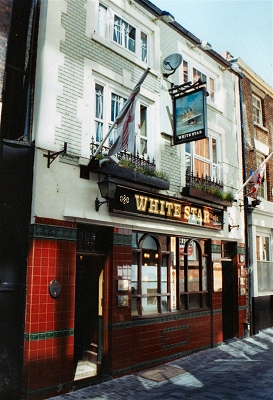
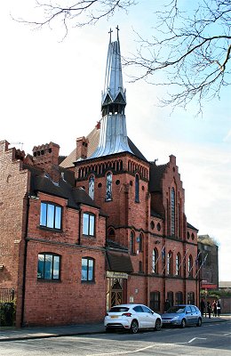
| Ma
Egerton's: This very characterful pub,
stuffed with theatrical memorabilia, is hidden up
Lord Nelson Street opposite the side entrance to
Lime Street Station. It's origins probablygo back
to the early 19th century, nut it was first
licensed, under the name of The Eagle,
in1878. Dubliner Mary Egerton, long a liverpool
pub landady and theatrical agent, took over this
pub in 1930, when it adopted the nickname that
became official in 1980. She numbered Charlie
Chaplin, Marie Lloyd and Fred Astaire among her
friends. She was also involved in the arrest of
the murderer Hawley Harvey Crippen. Many big
names in theatre and music have since visited the
pub. |
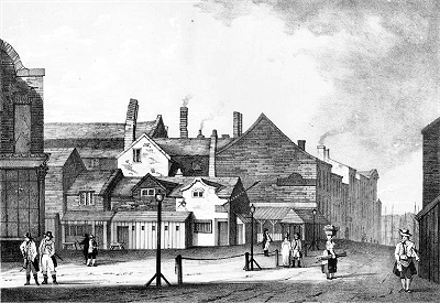
| Lime
Street Station: The superb iron and
glass structure of Lime Street Station is the
third station building on the site. George
Stevenson completed the world's first major
public railway between Liverpool and Manchester
in 1830. However the final tunnel through to Lime
Street was not completed until 1836. The present
station building was built in stages from 1867 to
1879. The span of the first shed at 200 ft (61 m)
was at the time the largest in the world. The
restoration and reglazing of the roof was
completed in 2001 and according to the Pevsner
Guide has revealed it as a thing of
spectacular beauty. Subsequent landscaping
of the area has properly opened up the prospect
of the station frontage. |
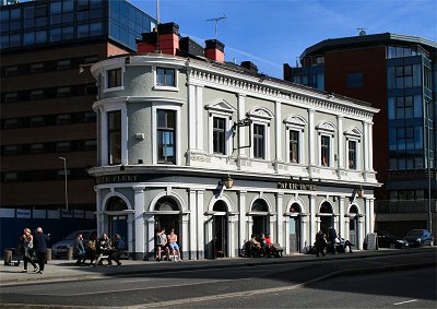
| The
Crown Hotel, opposite the station, is
one of Liverpool's most impressive pubs. It was
built by Walker's Brewery in 1905 on the site of
an earlier pub in a deliberately ostentatious
style to compete with those of wealthy local
brewer Robert Cain. The exterior is immediately
striking but hardly prepares you for the
magnificence of the two large interior rooms,
with elaborate plaster ceilings (complete with
gold leaf detailing) and wood panelling. |
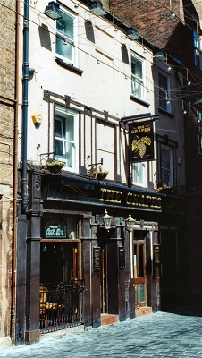
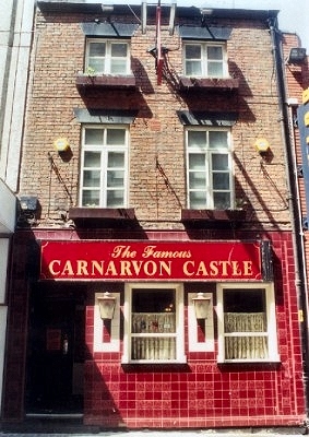
| The Vines
at the far end of Lime Street is a good example
of what Robert Cain was up to in Liverpool. There
was a pub here (Richmond's Snuggery) from 1813,
which was taken over by a Mr. A.B. Vines in 1867.
He gave his name to the present Baroque fantasy, one of a
number of pubs in the city demonstrating Cain's
commitment to flamboyant architecture. Known
locally as the Big House, it was
constructed in 1907 to the design of Walter W.
Thomas, who also designed the Crown Hotel and the
Philharmonic Dining Rooms. The clock was made by
the same company that made Big Ben. The interior
is as sumptuous as you might expect, with an
abundance of carved mahogany, plaster friezes and
copper-work. There are several ornate rooms,
crowned by the grand lounge at the rear with its
large glass dome, wooden panelling, ornate
fireplace with mirror and crystal chandeliers. |
| The
Adelphi Hotel is the third with the name
on this site, once the entrace to the Ranleagh
Tea Gardens. The others dated from 1826 and 1876.
It was built in 1911-14 by the Midland Railway
Company but because of the outbreak of the First
World War it was never completed according to
plan. It was at that time regarded as the most
luxurious hotel outside London. Situated close to
Lime Street station, its grandeur reflects the
importance of transatlantic travel to Liverpool
in the early part of the 20th century. |
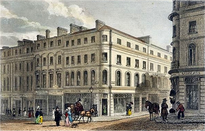
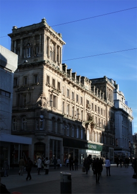
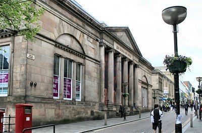
| Epstein's
Statue and Lewis's Department Store:
Opposite the Adelphi is the former Lewis's
Department Store sporting Jacob Epstein's bronze
figure on the prow of a ship above the main
entrance. The 18 ft (5.6 m) statue dates from
1954-6 and stands for the resurgence of Liverpool
after the war. The panels beneath, also by
Epstein (1955), show scenes from childhood - the
new generation of Liverpudlians (myself
included). The original store was devastated in
the blitz of May 1941, parts of the earlier
building of 1910-23 remaining only at the eastern
end on Renshaw Street, and the new store, the
largest in the city, opened in 1951. |
| David Lewis
(1823-1885) was born David Levy in London. In
1839, he moved to Liverpool to work for Benjamin
Hyam & Co., a firm of tailors and outfitters.
He rose rapidly to become the manager of the
Liverpool branch and, in 1842, was charged with
opening new branches in Scotland and Ireland and
supervising existing branches. Lewis started his
own business at 44 Ranelagh Street, Liverpool, in
1846, selling men's and boys' clothing mostly
designed and made in his own workshop. His
customers were mainly working class people who
had not been able to afford tailoring until then.
New ventures took off on the basis of strong
business ethics and he moved into women's
fashions and tobacco among other things. As well
as opening additional premises in Liverpool, he
also established stores in Manchester, Sheffield
and Birmingham. |
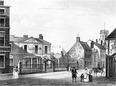
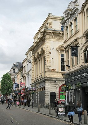
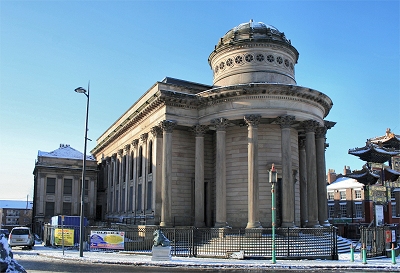
| Grand
Central, Renshaw Street: Lime Street
continues into Renshaw Street with a fine view
towards St. Luke's Church and the Anglican
Cathedral. The building of 1905 on Renshaw
Street, now known as Grand Central, was
originally the Central Hall of the Liverpool
Wesleyan Mission. A contemporary national
movement by the Methodists aimed to create an
identity distinct from the Church of England. It
was certainly managed here and as the Pevsner
guide puts it: 'The style promiscuously mingles
classical, Byzantine, Gothic and Jacobean, and
much of the terracotta has a swirly Art Nouveau
character. It all looks thoroughly un-churchlike
and might just as well have been a theatre or
department store.' In fact concerts and social
events (non-alcoholic of course) were held in
addition to religious services. It is currently
has a variety of uses, including being home to a
some unconventional boutiques. |
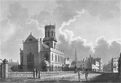
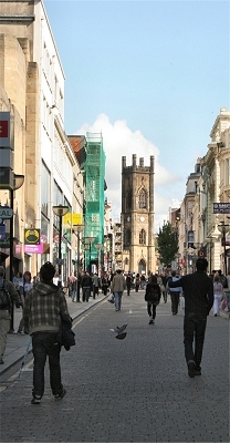
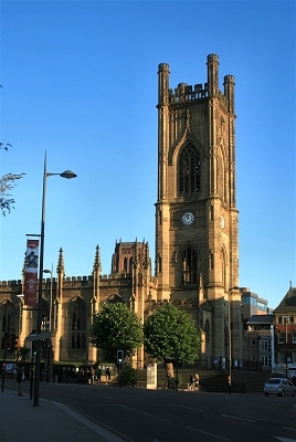
| St.
Luke's Church: Completed in 1831, St Luke's Church is a prominent Liverpool
landmark and one of its most beautiful churches,
though bombed in the May Blitz of 1941. The design made it suitable for
joint use as a concert hall, a role it played
until the Philharmonic Hall opened in 1849. It is known locally as
the 'bombed-out church' and is preserved as a memorial to the
Liverpool blitz. |
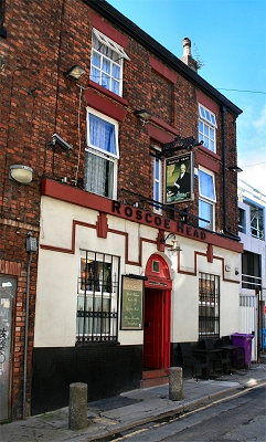
| The Roscoe Head:
Close to St. Luke's on Roscoe Street, the Roscoe
Head is a hidden gem of a pub. Traditional,
welcoming, vibrant and unspoiled, there are three
tiny rooms surrounding the small bar area. The
building became a pub in 1848, named after
Liverpool luminary William Roscoe. It is one of a small number of
British pubs that has been entered in the Good
Beer Guide ever since it was first published
in 1974. |
|
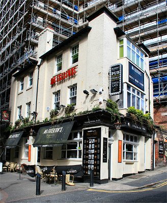 |
| Ma
Egerton's |
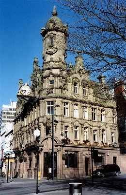 |
| The
Vines |
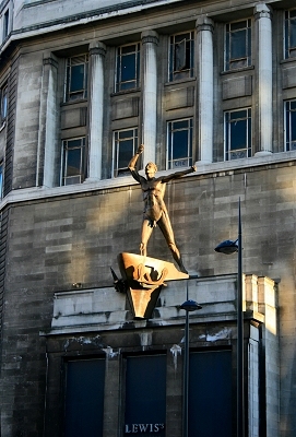 |
| Epstein's
Statue and Lewis's Department Store |
 |
| Renshaw
Street and part of the original Lewis's building |
 |
| St.
Luke's Church |
 |
| The
Roscoe Head |
|