|
|
|||||||||
|
|
|||||||||
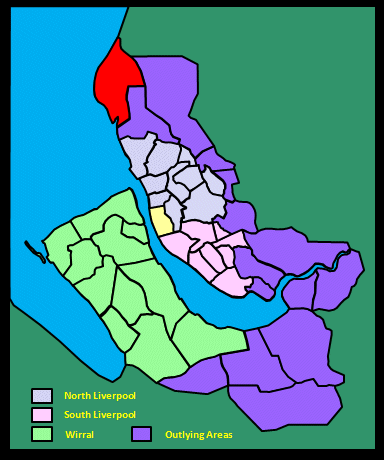
Home Page: merseySights  |
Home Page: allertonOak  |
|||
 |
| CLICK A BOOTPRINT FOR A RELEVANT WALK - LINKS TO OTHER SITES AT THE BOTTOM OF THE PAGE |
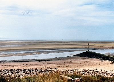 |
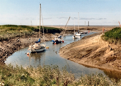
Estuary of the River Alt, Hightown The little River Alt, curiously, runs from Huyton (east of Liverpool) to Hightown on the Sefton coast. The coastline here is hauntingly isolated and lonely. It is also dynamic, to say the least, partly due to the effects of nature and partly to the efforts of man. 16th century maps show a small village called Altmouth on the south side of the river here. This was no longer in existence by the end of the 18th century, probably falling victim to shifting dunes and movement of the estuary. The Vikings are thought to have sailed up the river as far as Croxteth, where they established a settlement, and in the 17th century the river was navigable by sizeable boats for about 3 miles (5 km) inland. However much of the low-lying Sefton hinterland (known as the Mosses) was liable to serious flooding through the effects of tides and weather. At the end of the 18th century, new flood gates were constructed just upstream from the estuary and the land behind drained. |
 |
 |
Estuary of the River Alt, Hightown Between 1798 and 1855, Wignall's Bank was constucted on the north side of the Alt estuary to stabilise the dunes and provide grazing land. Ballings Warf was also constructed for moorings. This area was sold to the army in 1860 and became the present Altcar Rifle Range. However, stabilising the land and river here caused trouble down the coast. The Alt started to flow to the south close alongside the land and by 1919-20 houses at Blundellsands were being washed into the sea. In 1929, a Crosby resident, aided by the county council, attempted to solve the problem by blasting a channel out to sea using gelignite. He failed, but the problem was alleviated in 1936 by the construction of a long revetment wall out to sea that successfully diverted the river. |
|
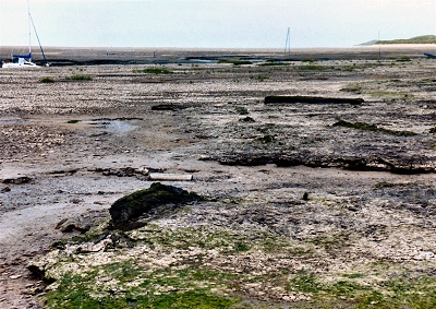 |
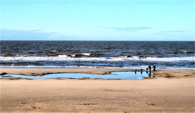
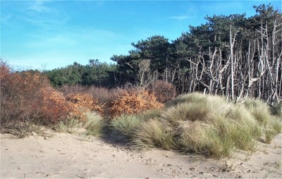
Submerged Forest, Hightown Near Hightown, between the estuary of the River Alt and the sand dunes, lie the blackened remains of 4000 year old pine, birch, willow and oak trees, exposed at low tide. These have been preserved in peat and largely flattened to ground level. In those days, the land reached much further out to sea and traces of human habitation have also been found. |
|
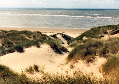 |
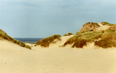
Dunes and Sea, Formby The higher dunes at Formby provide extensive views over the shore and the dune hinterland, and further afield the Liverpool skyline, the hills of north-east Wales, the mountains of Snowdonia, the Great Orme and even, in clear conditions, Anglesey. On this part of the Sefton coast you can enjoy a magnificent expanse of sand, sea and sky for mile after mile. It is a truly bracing experience to walk along here at any time of the year, especially near high tide. |
|
| Formby in Britannia (1695) In the moist and mossy soil turves are digged up which serve the inhabitants for fuel and candle light. Under the said turf there is a certain dead and blackish water, upon which there swimmeth I know not what unctuous matter; and in it swim little fishes that are caught by the diggers of turf. William Blundell of Crosby, writing about 1680, states that a local chemist had from the turf extracted 'an oil extraordinary sovereign for paralytic distempers'. |
||
| Formby in Lewis's Topographical Dictionary of England (1848) The chapelry comprises [an area] of which the surface is level, and the soil chiefly sand and moss; a considerable part is waste land, lying on a wild sea-shore that extends for several miles, where are numerous sand-hills and mosses, which abound in birds, many of them very rare, and where wild plants grow in great variety. The beach is well adapted for bathing, being very firm, and the water clear; the air is salubrious, and the chapelry is remarkable for longevity, and for freedom from fever and consumption. A brewery here, established nearly a century ago, is the property of Mr. Richard Tyrer. Formby Hall is the seat of the Formby family. The village had a chartered market, which has fallen into disuse. |
||
| Formby in the Victoria History of the County of Lancaster (1907) Formby is bounded on the west by the sea, the shore being protected by extensive and somewhat lofty sandhills, covered with a luxuriant growth of creeping willows and star grass, the latter being systematically planted to keep the sand from drifting away. Game abounds on these hills, wherefore the land is strictly preserved, and only a few footpaths across the forbidden ground are open to the public. The sandhills afford shelter from the sea winds to the three villages of Formby, Formby-by-the-Sea, and Freshfield, which form practically one town, situated on flat, sandy land, surrounded by fields intersected by ditches, where rye, wheat, potatoes (said to have been introduced into England by the wrecking of a vessel on the coast at or near Formby) and a variety of market produce flourish, including fields of asparagus, a specialty in the district. Fishing for shrimps and raking the sands for cockles affords employment to some of the inhabitants. Formby sandhills are famous to local botanists as the habitat of several uncommon and characteristic wild plants. [...] The village is large and scattered over the central portion of the area; in recent years residential districts have grown up by the sea. This is largely due to the railway facilities, the Lancashire and Yorkshire Company's line from Liverpool to Southport having stations called Formby and Freshfield. Formerly the township must have been much larger. As it is, Formby Point is a prominent feature of the coast-line; but the greater part of Raven Meols was long ago destroyed by the sea. About the beginning of the eighteenth century sand gradually overwhelmed the lands by the shore, changing the coast-line. The dark tilled soil of the ancient surface and the natural furrows made by the plough are occasionally found when clearing the ground of blown sand. [...] There are traditions that troops for the suppression of the rebellion of 1715 were embarked at Formby for Scotland, and that early in the eighteenth century a proposal was made that docks should be constructed here rather than at Liverpool. [...] Camden states that there was a small village named Alt Mouth near Formby, but it has disappeared, so that it is uncertain whether it was on the Raven Meols side of the river, or in Ince Blundell. In 1835 there was no dwelling here but a farmhouse; a rabbit warren adjoined. In a report prepared in 1839 the action of the winds and tides was noted. The effects were 'perceptible in the destruction of large quantities of land in the vicinity of the landmark, now in ruins, near the edge of the shore, and about the lifeboat house, which when erected thirty-five years ago stood 100 yards inland, but now projects about 300 yards before the hills and line of high water; in this period also at least 300 yards have been taken from before the landmark. The landmark mentioned was a tower on Formby Point; a corresponding tower was erected in Ince Blundell to assist navigators in entering the Mersey by Formby Channel. The land on the seaward side of the Alt, where is now the Altcar rifle range (in Little Crosby township), was reclaimed during last century [...]. In old days the leases used to include the right to fish on a given part of the shore, which was called a 'stall' and was treated as one of the fields of the farm; but when the great changes took place on the coast about this time (1700), this custom fell into disuse. |
||
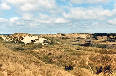 |
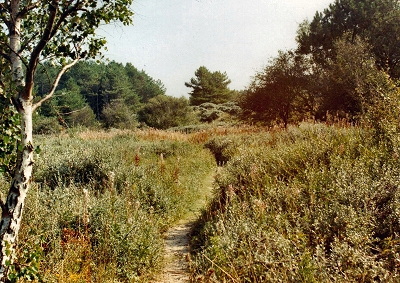
Dune Hinterland, Formby The dune hinterland at Formby is a vast and largely peaceful wilderness of scrubland, mostly inaccessible by car and a haven for flora and fauna. When I was a child in the 1950s, this was a frequent destination for Sunday picnics with Dad making tea and burning sausages over a primus stove in his only known excursions into the culinary world. In stark contrast to the present, the area was then crowded with cars and motorbikes. |
|
 |
Formby Point 5000 years ago here at the westernmost part of the Sefton coast, a land of fens and mudflats stretched much further to the west. Evidence of early habitation in those times has recently been discovered in the intertidal area in the form of semi-fossilised human and animal footprints that have been exposed by erosion. The animals represented include wild boar, sheep, horses, deer and aurochs, the latter a precursor of modern cattle that stood six feet (2 m) high at the shoulder. There are also blackened stumps of what look like ancient trees on the beach, the material resembling that of the submerged forest at Hightown. |
|
| Formby in Recollections of Old Liverpool (1863), an anonymous author recalling the mid-18th century Formby [...] was a great place for smugglers and smuggling. I don't think they wrecked as the Cheshire people did. [...] The Formby fishermen were pretty honest and hardworking, and could always make a good living by their calling, so that the smuggling they did was nothing to be compared to their Cheshire compatriots. Strings upon strings of ponies have I seen coming along the road from Formby, laden with the finny spoil. The ponies had panniers slung over their backs, while sometimes the fisherman's wife or child, if the horse could bear the double burden, was seated between them. These were called Formby Trotters. There were good fish caught in the river at that time and I have heard say that herrings used to be taken in great profusion in our vicinity. |
||
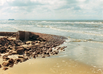 |
The Old Lifeboat Station, Formby These are the remains of Britain's first lifeboat station at Formby Point, originally dating from the 1770s but washed away in the early 20th century by the encroaching sea. Another reminder of the dynamic nature of the coastline is just to the north of here, where there is an area of scattered eroded housing rubble, the remains of old fishermen's cottages. From here, the distant horizon to the north opens up, with Blackpool Tower and roller coaster visible and, further west, the mountains of the Lake District ending in the isolated hump of Black Combe. |
|
 |
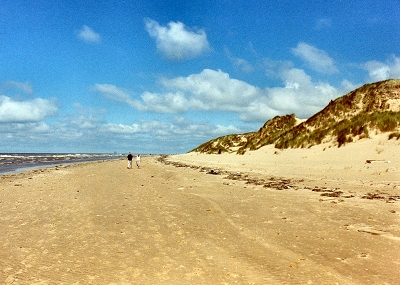
Sand, Sea and Sky at Freshfield ... and the world to yourself. |
|
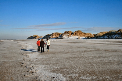 |
Formby Point This morning in January 2010, the temperature was -8C and the tide line of seawater had frozen over. |
|
 |
Desert Ambience at Freshfield Sir George Head wrote in 1835: 'It is with extreme pleasure that one explores recesses where nothing but the sky is to be seen, and which seem as wild and solitary as an Arabian desert.' Could he have been thinking of this area at the start of the Fisherman's Path near Ainsdale Nature Reserve? He goes on: 'Rabbits burrow here abundantly with little or nothing apparently to feed upon; and small green lizards of a colour beautifully vivid, are plentiful. A species of toad, not common, is also met with.' It is encouraging that things have not changed much in 170 years, though the rabbit population never properly recovered following the outbreak of mixomatosis in the 1950s. The toad he saw was the natterjack and the wet slacks near here are home to one of the most important populations in England. |
|
 |
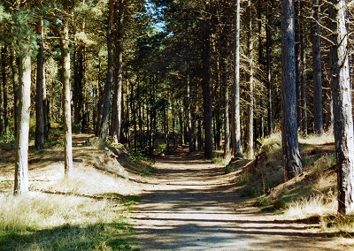
Windswept Pines, Freshfield | |
 |
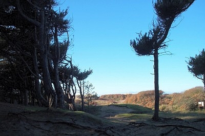
Weathered Pines, Freshfield The extensive pinewoods are rich in fungi, with over 200 species recorded. |
|
 |
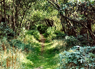
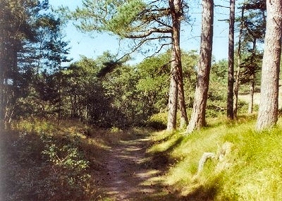
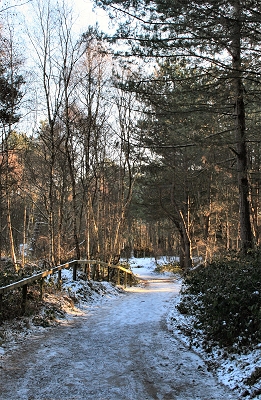
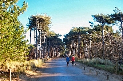
The Old Fisherman's Path, Freshfield The Fisherman's and Old Fisherman's Paths connect the shore to Freshfield along the southern edge of Ainsdale Nature Reserve. I make no apologies for including several pictures - it is a beautiful tranquil area of woods and scrubland. |
|
 |
The Old Fisherman's Path, Freshfield | |
 |
The Old Fisherman's Path, Freshfield | |
 |
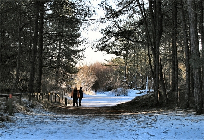
The Fisherman's Path, Freshfield | |
 |
The Fisherman's Path, Freshfield Winter light on the trek home. |
|
 |
The Fisherman's Path in Winter | |
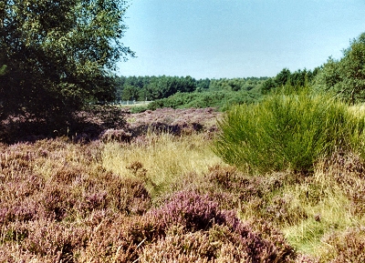 |
Field of Heather, Freshfield | |
 |
Victoria Road, Freshfield This is the main road from Freshfield Station down to the shore. It leads past ostentatious mansions to the National Trust's Red Squirrel Sanctuary (on the right in this picture) and on through pinewoods to car parking facilities near the beach. |
|
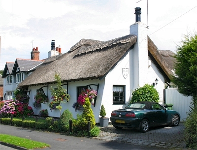 |
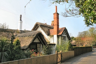
Old Cottage, Freshfield This lovely old cottage is dated 1613. My thanks to Don Garton for this picture. |
|
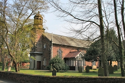 |
St. Peter's Church, Freshfield St. Peter's dates from 1746. It is unusual in being designed in a contemporary Georgian style, with elegant clear glass windows, rather than the the more usual mock-mediaevalism of slightly later times. The name comes from the ancient chapel of St. Peter that stood nearer the sea on the site of the present St. Lukes church and was destroyed during a storm in 1739. In the 1870's, the east end was removed and the present chancel, sanctuary and side chapel (The Formby Chapel) added in a then fashionable neo-Gothic style, presenting us nowadays with something of a hybrid. |
|
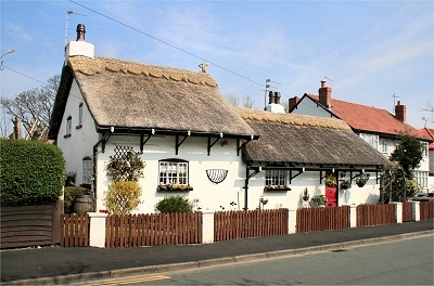 |
Old Cottage, Freshfield Although Formby and Freshfield are to a large extent housing areas developed over the last 100 years or so on the back of the rail link into Liverpool, there are many examples of the habitations of the earlier fishing and farming communities. This cottage in Freshfield is a nice example. |
|
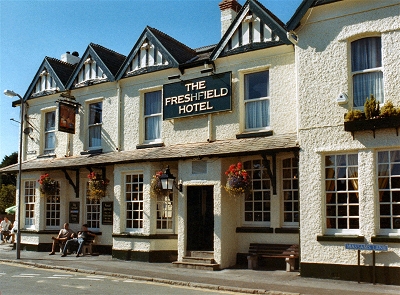 |
The Freshfield Hotel, Freshfield The Freshfield Hotel is an excellent unpretentious pub conveniently located near Freshfield station on Massam's Lane to provide last minute refreshments for walkers. |
|
 |
Tower Grange, Freshfield Tower Grange and the neighbouring Tower House are claimed to incorporate part of a 13th century monastic grange that belonged to Whalley Abbey, but are more likely based on 17th century farm buildings. There is a prominent square tower. The present topsy-turvy cottages are largely a fairy tale fantasy dating from reconstruction undertaken in 1904. |
|
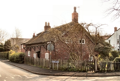 |
Old Cottage, Freshfield Another attractive cottage, this one being early 18th century. |
|
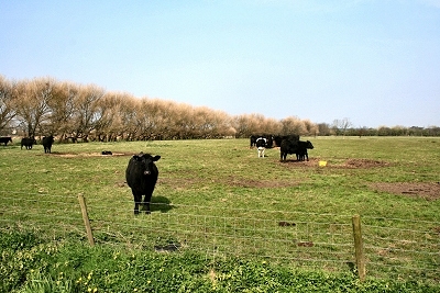 |
Formby Moss Notwithstanding these cute characters, Formby Moss is predominantly horse country. |
|
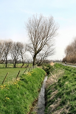 |
Formby Moss Formby Moss presents a flat landscape of windswept trees and drainage ditches, peaceful and deserted except for a rich backdrop of birdsong. |
|
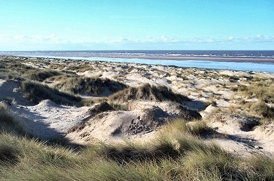 |
Dunes at Ainsdale The present name Ainsdale was known by the 16th century, but may have referred to land or a village washed away by the sea in earlier times. The first appearance on a map was in 1746. The dunes here at the northern end are unusual - low lying and wavelike. They provide a habitat for sand lizards. |
|
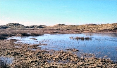 |
Dune Slack at Ainsdale The slacks are wetlands behind the dunes that front the sea. Here at Ainsdale National Nature Reserve, they are a breeding ground for one of the most important populations of natterjack toads in England. The slacks are also home to many wild flowers, some of which are rare in the UK. The surrounding grasslands support wild orchids and specialised insects such as the northern dune tiger beetle. |
|
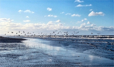 |
Seabirds at Ainsdale Large numbers of wading birds feed on the shore, especially, as here, in winter. |
|