Huyton in Lewis's Topographical Dictionary of England (1848)
The land is principally arable; about 2025 acres are woodland and park-grounds: the surface is elevated and undulating, the soil various, the air salubrious, and the scenery beautiful. The stream anciently designated the Terbeck skirts the southern verge of the parish; rising near Childwall, and passing by Little Woolton and Tarbock, it descends into the Mersey at Hale-Bank, in Halewood. A branch, also, of the Alt, a small affluent of the Irish Sea, flows from the vicinity of Huyton to the north-west, by Croxteth Park. Coal, but of inferior quality, is raised; and to the east of the village of Huyton, is an excellent slatequarry. A brewery, belonging to Mr. Barker, was established in 1825. |
Huyton with Roby in the Victoria History of the County of Lancaster (1907)
The original township of Huyton has been united with Roby to form the township of Huyton with Roby. To them in 1877 was added Thingwall, part of the parish of Childwall. [...] The country is somewhat undulating in the north, but flat in most places. This is quite a residential district with the dwellers in the city of Liverpool, for pleasant country houses with gardens and shrubberies are seen on all sides. Beyond the houses are open fields, some pastures, others where corn, potatoes, and turnips are generally cultivated. [...] At Huyton Quarry the character of the country varies; coal mines begin to indicate their presence by shafts and ventilators. The Huyton Quarry mine is the nearest to Liverpool of the South Lancashire mines. |
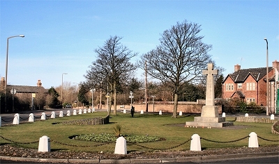 |
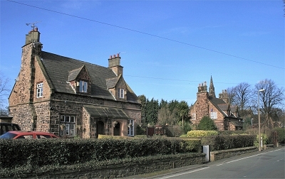
The Village Green, Knowsley
Opposite St. Mary's Church in the centre of Knowsley village is the village green, known locally as the Knowsley Triangle. There used to be a maypole here and the area still retains an authentic village atmosphere, surprising to those who think of Knowsley as the entire borough or as the huge neighbouring country estate, seat of the Stanley family, Earls of Derby, since the 14th century and a safari park since 1971. |
|
Knowsley in the Victoria History of the County of Lancaster (1907)
The country is generally flat, very slightly undulating on the east, where it reaches 330 ft. above sealevel. The land which lies outside the park itself is divided into rich arable fields, yielding crops of potatoes, turnips, and cereals. [...] Game, in the shape of pheasants, partridges, and hares, is particularly abundant in the district. The north of the township lies on the edge of mossland, the birches and bracken in the plantations being typical of moss vegetation. The village of Knowsley, which is situated in the north-west, is entirely modern. [...] The well-wooded park surrounding Knowsley Hall is the principal feature of the township, occupying the eastern half of its area, and stretching over the boundary into Eccleston. |
Knowsley Park in the The Stanleys of Knowsley (1868) by William Pollard
The scenery in the park, which is beautifully undulating, is exceedingly varied, abounding in charming lawn and woodland views, with noble groups of trees in different elevated positions. From almost every part of the park, but more especially that portion of it more immediately in front of the hall, the view of the surrounding country is commanding and beautiful, not being confined to inland scenery, but embracing on the west a splendid marine and sea prospect. [...] The park throughout is magnificently wooded, more especially that portion which is known as the Gladewoods, in which there is one large tree constantly attracting much attention and interest from the fact of its having been twisted in the stem either by some freak of nature or other singular agency, which gives it the appearance of a huge corkscrew. The park also contains a large and artistically arranged lake, upward of 90 acres in extent. [...] A large portion of the eastern side of the park, consisting of several hundreds of acres, forms the deer park, in which there are numerous herds of red, fallow, and other deer. The gardens and pleasure grounds, which are very extensive, are most artistically laid out and beautifully decorated with works of art. |
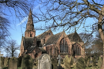 |
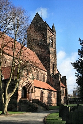
St. Mary's Church, Knowsley Village
St. Mary's is Knowsley Parish Church and was built between 1843-93 with funding from the Earls of Derby. |
|
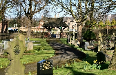 |
St. Mary's Churchyard, Knowsley Village |
|
 |
Old Cottages, Knowsley Village
Numerous 19th century cottages in Knowsley Village contribute to the atmosphere of bygone times. |
|
 |
St. Chad's Church, Kirkby
There has been a church here in Kirkby for over 1100 years. St. Chad (Chad of Mercia), who died in 672, was a prominent Anglo-Saxon churchman. It features in the Domesday Book and an elaborately sculpted Saxon (or possibly early Norman) sandstone font survives, which has been relocated inside the present church. The foundations of an earlier Georgian chapel of 1766 (replacing a yet earlier chapel) can still be seen in the grounds, with the remains of a small plinth where the font once stood and a monument marking the position of the altar. It was dismantled in 1872 and the stone used to construct the boundary wall. St. Chad's was completed in 1871 at the expense of the 4th Earl of Sefton with the help of the free labour from his tenants in the area. Local sandstone was carried from quarries in Kirkby and Melling. It is said that at the time of building, there was a dispute between the Kirkby farmers and those from Simonswood about the design of the pillars for the church. They settled the argument by building octagonal pillars along the north aisle and round pillars along the south aisle. To this day I understand that, at Harvest Festival time, Kirkby farmers decorate the south of the church and Simonswood farmers the north, and do not sit with each other! There are a few scattered remains of what was once a farming community in Kirkby. The construction of the East Lancashire Road in 1935 opened up the area for industrial development and a vast munitions factory was built during the war, employing 23,000 people at its peak. In 1946-7, Liverpool Corporation purchased the site together with an additional 4000 acres (1600 ha) of adjoining farmland from the 7th Earl of Sefton. Part of the area was gradually redeveloped as an industrial estate, becoming one of the largest in the country by the 1970s. On the back of industrial developments and the clearance of slum (or bombed) housing in Liverpool, Kirby became a 'New Town', the population increasing from 3,000 in 1945 to 52,000 in 1961. |
|
Kirkby in the Victoria History of the County of Lancaster (1907)
This township [...] is open, generally flat, [...] portioned out into arable fields, divided by low hawthorn hedges. There is but little pasture. Potatoes, wheat, and oats are largely cultivated in a sandy and clayey soil. There are scattered farmsteads and isolated plantations of different kinds of trees, with undergrowths of rhododendrons. These plantations are strictly preserved, and afford cover to much game, chiefly hares and pheasants. |