|
|
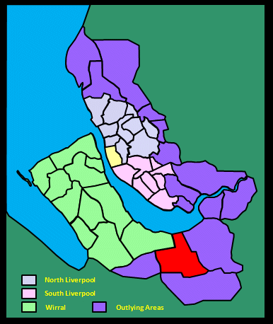
|||||||||
|
|
|||||||||
Home Page: merseySights  |
Home Page: allertonOak  |
|||
 |
| CLICK A BOOTPRINT FOR A RELEVANT WALK - LINKS TO OTHER SITES AT THE BOTTOM OF THE PAGE |
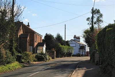 |
Little Barrow The tiny hamlet of Little Barrow sits on the end of a low sandstone ridge above the Gowy Marshes. The few buildings cluster around the Foxcote Manor pub (unfortunately closed down when last visited). Originally The Railway, it has been a pub since about 1850, though the buildings are older dwellings. The Foxcote Manor was originally a steam locomotive that served the nearby line and station. |
 |
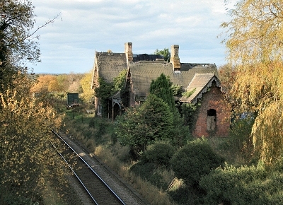 |
Tarvin and Barrow Station, Little Barrow This station on the Cheshire Lines Committee railway to Chester first opened in 1874. It was marked as Tarvin and Barrow Station on the map of that time, which also shows the quarry over the road from where the stone used to construct St. Peter's church in Plemstall was obtained (the stonemason was a notorious local drunk, who presumably frequented the pub up the road). The station was once busy with shipments of milk from the local pastures and in the years leading up to the First World War was a destination for holidaymakers from the industrial towns to the north-east. It was closed to passengers in 1953 and is now derelict, although the railway line remains in use. |
|
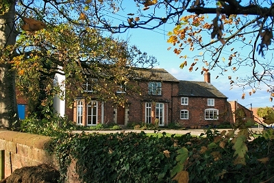 |
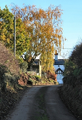
Barrow Lodge, Little Barrow | |
 |
Sunken Lane at Little Barrow This ancient sunken lane drops down steeply from the centre of Little Barrow, carving its way deeply through the sandstone bedrock. |
|
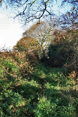 |
Ferma Lane near Little Barrow Ferma Lane is an ancient way that contours along the eastern edge of the Gowy Marshes from Little Barrow to Great Barrow. The name comes from the Old English for fen. It is now a rough track winding among high hedges of oak, hawthorn, blackthorn, hazel, ash and elder. The diversity of tree types indicates great antiquity, at least 500 years. |
|
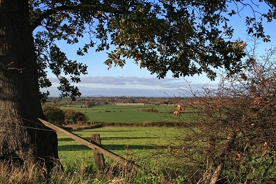 |
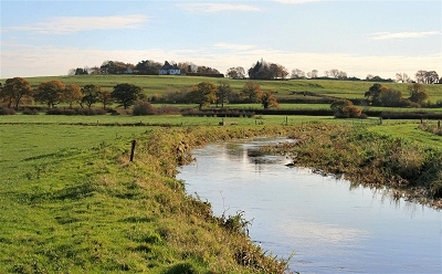
The Gowy Marshes from near Little Barrow The lower reaches of the River Gowy were once a vast, water-logged marshland bordering a bay on the southern edge of the Mersey. The area then cut northern Cheshire in half and was largely impassable. The original settlements around here, such as Plemstall, Little Barrow, Dunham-on-the-Hill, Ince and Thornton-le-Moors, all grew up on the few isolated sandstone outcrops available. It is thought that the first attempts to drain and dyke the marshes took place in the latter Middle Ages. The area is rich in wild life, whether of the water, land or air. |
|
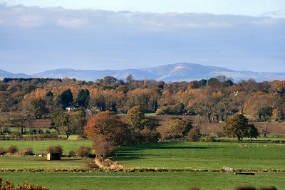 |
Moel Fammau from near Little Barrow | |
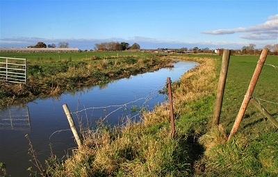 |
The River Gowy The tranquil River Gowy arises in Cheshire's Peckforton Hills only 280 ft (90 m) above sea level and follows a 20 mile (32 km) course to the River Mersey adjacent to the remains of the ancient Stanlow Abbey. The mouth of the river was much modified following the construction of the Manchester Ship Canal in 1888-94 and Stanlow Oil Refinery, beginning in 1922. |
|
 |
The River Gowy and Little Barrow | |
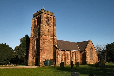 |
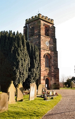
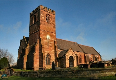
St. Lawrence's Church, Stoak The little village of Stoak is these days entirely encircled by motorways and the Shropshire Union Canal. A Saxon chapel was originally on the site and fragments of architecture still present in the 19th century showed that a new church must have been built soon after the Norman conquest. Sources from the 14th century speak of 'a sumptuous fabric of stone and wood, of great size, with four bells, [...] then becoming ruinous'. The present church of St. Lawrence dates the rebuilding of 1827, though the north wall and the Tudor hammerbeam roof of the nave were left largely intact. |
|
| Stoak in Lewis's Topographical Dictionary of England (1848) The church, which is the burial-place of the Bunbury family, has a Norman doorway, some ancient wooden screen-work, and a small chapel attached to the south side of the chancel; it was partially rebuilt in the year 1827. |
||
 |
St. Lawrence's Church, Stoak | |
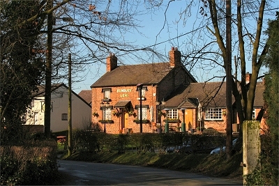 |
The Bunbury Arms, Stoak | |
 |
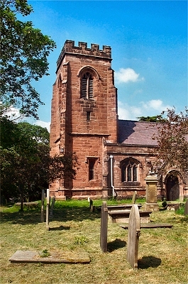
St. Mary's Church, Thornton-le-Moors A chapel was present on the site of St. Mary's in Saxon times and is recorded in the Domesday Book. The nave, chancel, south aisle and south door of the present sandstone church (formerly dedicated to St Helen) date from the 14th century and the chancel retains its medieval hammerbeam roof. A chapel (the Elton Chapel) was added in the 16th century. The tower also dates from this time, but was damaged by fire in 1909 and rebuilt in 1910. A south porch was added in the late 17th century and a full restoration was carried out in 1878. Inside, the altar rails and altar table are dated 1694 and here are two 17th century fonts and a mediaeval piscina. |
|
| Thornton-le-Moors in Lewis's Topographical Dictionary of England (1848) The parish is situated on the banks of the river Mersey [...]. The surface is in general flat; the soil partakes of the nature of peat, and on the rising grounds is either marl or a strong clay. There is a packet daily by the river; and the Ellesmere and Chester canal, which passes about a mile from the western boundary of the parish, also affords facilities of conveyance. [...] The church contains portions of several styles, with a handsome tower. |
||
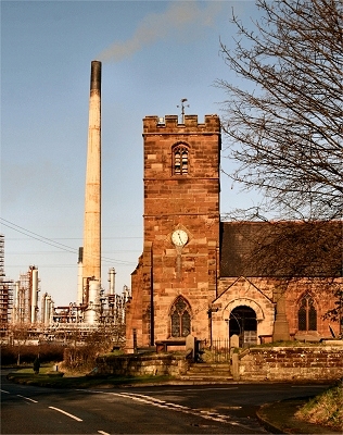 |
Ancient and Modern at Thornton-le-Moors The vast Stanlow refinery forms a surreal backdrop to St. Mary's church. |
|
 |
The Church of St. James the Great, Ince Ince is an ancient settlement that, although hemmed in by industrial sites, retains the appropriate charm and atmosphere. The approach down a leafy lane sets the scene. The name comes from the Welsh 'Ynys' or island as it was once the only habitable site in the surrounding marshland. The Church of St. James the Great is built on the site of a Norman chapel, no trace of which remains. The present church dates from the middle ages (there are 14th and 15th century windows in the chancel), though the tower and part of the chancel are all that remain of this; the remainder dates from a major rebuilding in 1854. The area is rich in ecclesiastical associations, the remains of the historic Cistercian abbey of Stanlow, founded in 1178, being nearby at Stanlow Point. It must have been a lonely spot then, but is hardly less isolated now, being inaccessible to the public situated as it is between the Manchester Ship Canal and the River Mersey. |
|
| Ince in Lewis's Topographical Dictionary of England (1848) This place was distinguished for a monastic institution that belonged to the abbots of St. Werburgh's, Chester. The dormitory, refectory, and chapel still remain; the two former have been converted into a farmhouse, and the chapel into a barn, an object of great beauty, the eastern side being thickly covered with ivy. The walls are about six feet in thickness, with eight large bay windows, now bricked up; and the monastery was surrounded by a moat, still traceable by parts of its outer walls. The parish comprises by measurement 1500 acres, and is bounded on the north by the river Mersey, where a pier has been constructed, at the distance of half a mile from the village. The central portion is rising ground, and each extremity consists of marsh land protected by an embankment from the tides of the Mersey, which flow up two small brooks forming the eastern and western boundaries of the parish. [...] The church, situated on the highest point of a rock, has some traces in the Norman style, but the greater part of the building is of later date. |
||
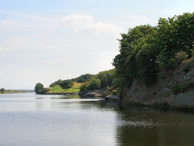 |
The Manchester Ship Canal at Ince A delightfully rural stretch of the canal. |
|
| LINKS |
| Ince at Scrapbook of Cheshire Antiquities |
| Thronton-Le-Moors and Stoak at Scrapbook of Cheshire Antiquities |
| Mersey Estuary at wirral.gov.uk |
| Old photos at the Francis Frith Collection |