| Bootle, Linacre,
Litherland and Orrell |
| The road
from Kirkdale to Bootle was Field
Lane. Bootle
village had grown from Saxon times around the
important Bootle Spring, which became Bootle Water Works.
The spring
and the associated waterworks once supplied
Liverpool with fresh water, and the present
Waterworks Street and Well Lane recall those
days. |
| |
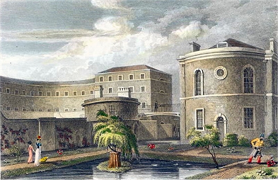
At
Bootle-cum-Linacre are the works for supplying
the town of Liverpool with water, from a spring
which formerly discharged itself into the sea at
Bootle Bay, after turning a mill within about
half a mile from its source. [... an] act was
obtained in 1799 [...] and water has since been
brought from Bootle to Liverpool. [HCP] |
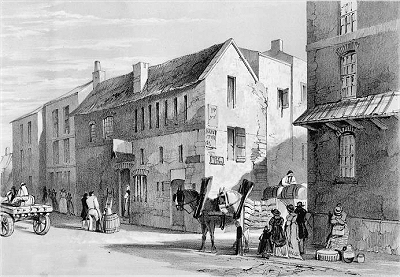
| The village
was disposed about a square area bounded on three
sides by Litherland Road, Merton Road (probably a
later name) and Bootle Lane, and boasted a number
of pubs: the Bootle Inn, the Stanley Arms Inn,
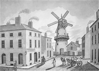
the Bull Inn and the Jaw Bone Tavern. Clayfield
Lane led east to Walton village
past a land mark on the elevated ground
there. The other road to the east, Grave
House Lane, has been lost. Little remains of
the original village, but the Old Hall on Merton
Road, once a hunting lodge owned by the Stanley
family, dates from about 1770. |
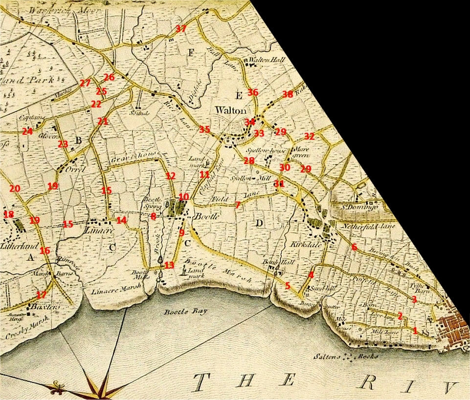
| By
the early 19th century the local shore, where
there was another its land mark, was
attracting bathers and horse riding. Wealthier
residents were moving into their newly built
villas along the coast and Merton Road connected
this area with the village. Irlam's Lane (a local
family name) led on from Merton Road to Bootle
Mills, where the little brook known
as the Mill Stream that flowed out of
Bootle Spring was dammed twice near to its
outlet, the lower one powering a watermill (there
is still a Brook Road here). |
| |
Bootle cum
Linacre lies near the sea on a very sandy soil
and contains some well-built houses. A very
copious spring of fine, soft, pure water rises
near it, which about half a mile below turns a
mill and soon after falls into the sea at Bootle
Bay. [...] Linacre, a pretty rural village, is a
distinct township, but a member of the manor of
Bootle. It lies adjacent to the sea, on the west.
[HOL] |
| |
The ride along the
beach is, in the summer, remarkably pleasant, and
much frequented. The sands are hard and smooth,
and the wind, especially if westerly, cool and
refreshing. At the distance of three miles from
the town, a road turns off inland, at Bootle
mills, where are two good houses provided with
accommodations for persons who resort here for
the benefit of sea-bathing. [SIL] |
| |
At this
place are some works for supplying the town of
Liverpool with water, from a spring which
formerly discharged itself at Bootle bay, on the
coast, after turning a mill within half a mile of
its source. [...] Anciently there were paperworks
and flour-mills at Bootle; the latter were
destroyed by fire some years ago. The township is
beautifully situated on the shores of the Mersey,
at its mouth. [...] The beach is firm, of great
extent, and much resorted to for bathing, and
horse exercise. The village is well built; there
are numerous elegant villas, and ranges of houses
inhabited by the merchants of Liverpool, and some
excellent hotels and lodging-houses with every
accommodation for visiters. The expansive views
of the sea, the Cheshire coast, mountains of
Wales, &c., are highly attractive in this
quarter. [TDE] |
| Litherland
Road led from Bootle village to Linacre
(the township was generally known as
Bootle-cum-Linacre at that time). Linacre
village was a tiny settlement located around the
bend in Linacre
Lane. Marsh Lane headed south a short way before
turning over Linacre Marsh towards Bootle
Mills on a road now lost. John Bibby,
founder of the shipping line, was to have a house
known as Mount Pleasant on Linacre Marsh.
Returning home one night in 1840, he was attacked
by highwaymen and robbed. They beat him
unconscious and threw him into a nearby pond,
where he drowned, but they only escaped with a
pocket watch. |
| Linacre
Lane went north over Rimrose Brook into Litherland,
up to this time often known as Down Litherland to
distinguish it from Up Litherland, an area to the
west of Ormskirk now subsumed within Aughton. The
village spread along and about Sefton Road. Marsh
Lane headed towards the shore at the outlet of Rimrose
Brook (soon to have a bridge with a hotel on the
other side) and Crosby Road continued along Crosby
Marsh towards Waterloo. The latter area was
to become a major draw for the wealthy and their
villas from about 1800. |
| Marsh
Lane continued in the other direction into Orrell
Lane and then Moor Lane. Orrell Lane itself
turned right to Orrell village and
Linacre Lane, which continued to Watts Lane and
Orrell Lane. From Orrell village, Park
Lane led to Orrell Lane, which became Captain's
Lane at this point. Note also Bull Lane, Black
Bull Lane (leading to the Black Bull pub), and
Park Gate Lane named after Stand Park,
presumably a deer park or similar that had lapsed
back into the wild by this time. |
|
 |
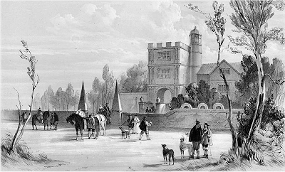
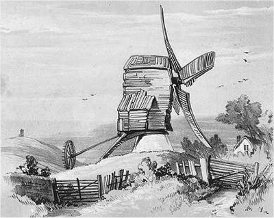
| Landmark
near Bootle |
| |
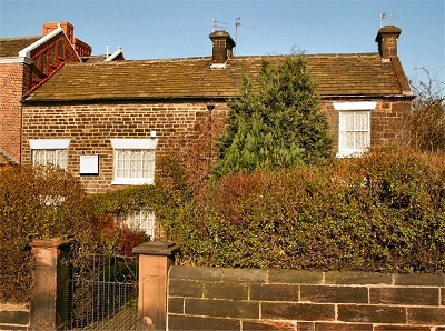 |
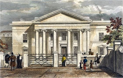
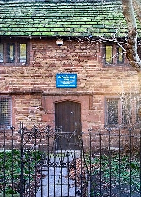
| The
Old Hall, Bootle |
| |
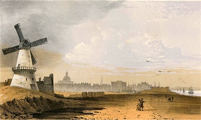
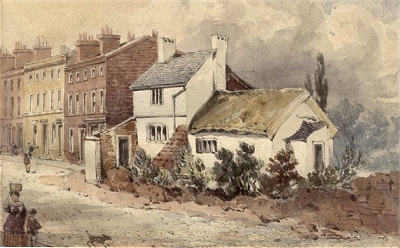
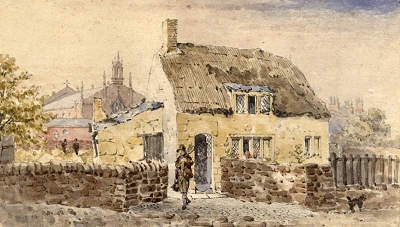 |
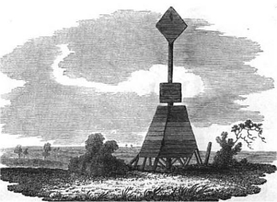
| Cottage
by Black Bull Lane |
|