|
|
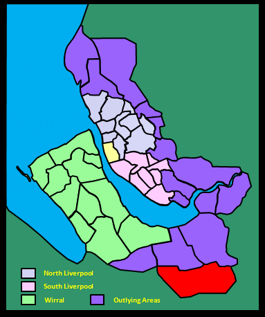
|||||||||
|
|
|||||||||
Home Page: merseySights  |
Home Page: allertonOak  |
|||
 |
| CLICK A BOOTPRINT FOR A RELEVANT WALK - LINKS TO OTHER SITES AT THE BOTTOM OF THE PAGE |
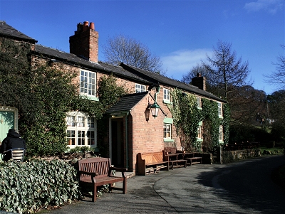 |
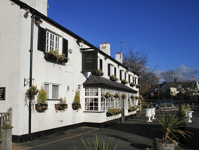
The Boot at Willington The Boot Inn (originally The Cat) at Willington possibly acquired its name from nearby Boothsdale (or from Willington Boot, ouch!, as was suggested to me by someone - yes, you know who you are). The first dwelling house on this site was built in 1815 and had probably become a pub by 1848. By the end of the 19th century, four or five dwelling houses probably nestled under the same roof. The present pub, for which the houses have been knocked through, is well worth seeking out - a cosy interior full of character with excellent beer and food. |
 |
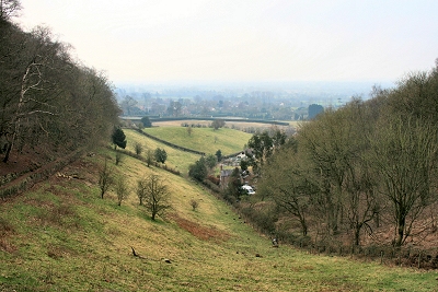 |
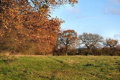
Boothsdale, Willington Boothsdale is a steep-sided valley in the Cheshire Sandstone Ridge near Willington. The Boothsdale area is known as Little Switzerland, in common with numerous other places in Europe (e.g. in the Netherlands) in which mountains are conspicuous by their absence. |
|
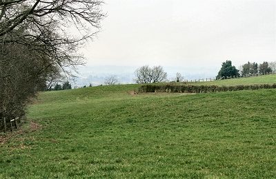 |
Kelsborrow Castle Kelsborrow Castle is an Iron Age hill fort, one of several on the Cheshire Sandstone ridge. It has a commanding view over the Cheshire Plain to the west and south and was able to exploit the natural steep slopes of the area to create a defensive site. The remains of an artificial bank and ditch are still discernable. |
|
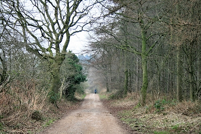 |
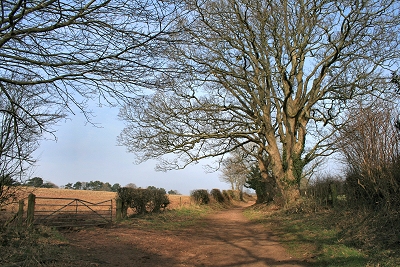
King's Gate, Willington King's Gate is the entrance to Primrose Hill Wood from the west. |
|
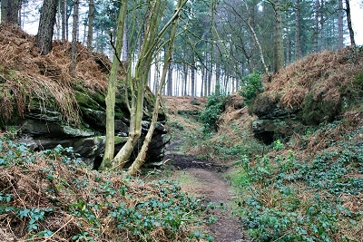 |
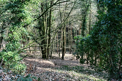
The Urchins' Kitchen, Willington Here the word urchin apparently has its older meaning of elf and the place does have a mysterious atmosphere. Glacial action has carved out several steep-sided valleys in the Willington area, but here in Primrose Hill Wood glacial melt water has exposed the sandstone bedrock strata. |
|
 |
Hangingstone Hill Seen here in the view to the north from Primrose Hill Wood. |
|
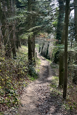 |
Path near Tirley Garth, Willington This very pleasant public footpath follows the western boundary of the Tirley Garth estate. The house itself is a rather grand Art and Crafts style mansion completed in 1912 that has extensive ornamental gardens open to the public. |
|
 |
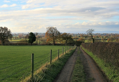
The Sandstone Trail at Willington Corner Cheshire?s Sandstone Trail is one of the finest and most popular long distance walks in North West England. It stretches for 34 miles (55 km) from the centre of the ancient market town of Frodsham in the north to Georgian Whitchurch in Shropshire in the south. For most of the way it follows the dramatic, wooded sandstone ridge that runs roughly top to bottom across Cheshire. |
|
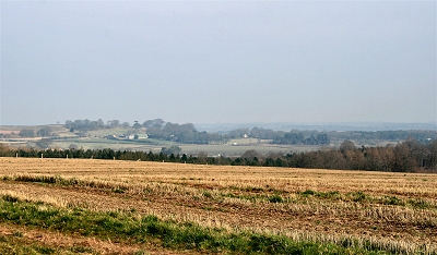 |
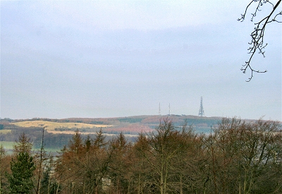
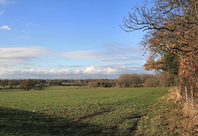
The Cheshire Countryside from Willington Corner This is the view over the peaceful Cheshire countryside from the Sandstone Trail to the south-east at Willington Corner. |
|
 |
Pearl Hole, Willington Pearl Hole is another of the steep-sided valleys in the Willington area carved out by glacial action. The east side is vertical rock and there was once a spring here. |
|
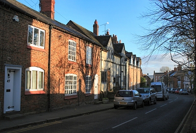 |
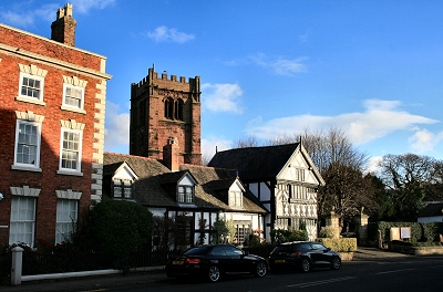
High Street, Tarvin Tarvin is an ancient village, mentioned in the Domesday Book (1086), though most of the present buildings are post-1752, the year of a disastrous fire. The village centre is undoubtedly very pretty though. |
|
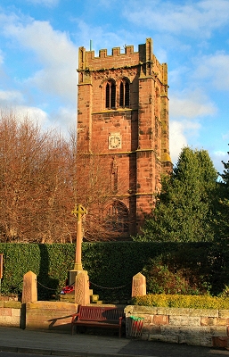 |
St. Andrew's Church, Tarvin There was a church on this site in the 12th century, which was rebuilt in the 14th century; the south wall and south arcade survive from this time. Most of the remaining building, including the tower, is 15th century, with further restorations taking place in the 18th and 19th centuries. There are reminders of the Civil War in musket and cannon ball marks to the side of the tower. The approach from Church Street is very attractive, with 18th century gatepiers and an avenue of lime trees, and the churchyard is interesting and atmospheric. |
|
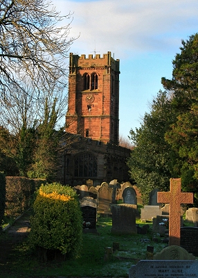 |
St. Andrew's Churchyard, Tarvin | |
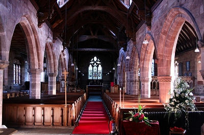 |
St. Andrew's Church Interior, Tarvin One of the most striking features of the beautiful interior of St. Andrew's Church is the 1650 Gothic hammerbeam roof of the nave. The south arcade and south aisle roof are 14th century and the Bruen Chapel, south of the chancel, has windows of this period. |
|
 |
The Old Grammar School, Tarvin The Old Grammar School was founded by a London merchant in the early 17th century. |
|
 |
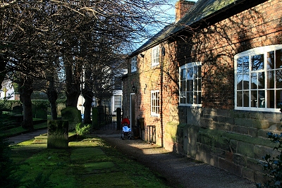
Church Cottages and Church House, Tarvin | |
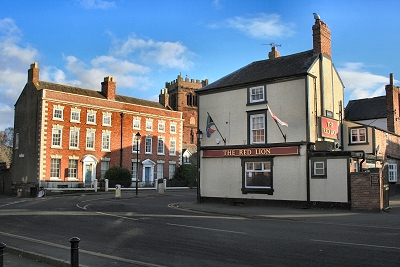 |
The Red Lion and Georgian Town Houses, Tarvin These fine Georgian town houses, known as The Flaggs and Hamilton House were built in 1756 to replace buildings destroyed by the fire of 1752. The Red Lion pub dates from the same period. |
|
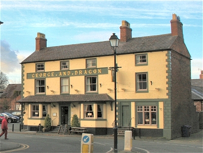 |
The George and Dragon, Tarvin The George and Dragon pub dates from the period immediately following the fire of 1752. |
|
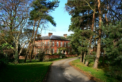 |
Hockenhull Hall, near Tarvin The large square planned Hall dates from the late 17th century, but was remodelled in the early 18th century, the two main façades being ca. 1720. |
|
 |
Hockenhull Lane, near Tarvin | |
 |
Platts Lane, near Tarvin Platts Lane is part of the ancient London to Holyhead road that had been in use for centuries when it was superceded by the Chester to Nantwich turnpike (toll) road in 1743. It is part of a surviving section that runs from Christleton to Duddon. Its great age is attested by the variety of trees forming the hedges. It was a narrow packhorse route, in places elevated above the surrounding marshy ground by a sandstone causeway (still discernible in places). |
|
 |
View from Platts Lane, near Tarvin | |
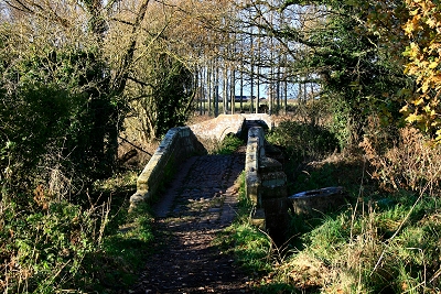 |
The Eastern and Central Packhorse Bridges, Hockenhull Platts The three narrow packhorse bridges of Hockenhull Platts, connected by causeways, date from the late 18th century, although there were bridges here in the 14th century; Edward the Black Prince passed through in 1353 and ordered repair work. The name Hockenhull is possibly of Welsh origin, hull coming from heol or paved way. This area was near the Welsh border in Anglo-Saxon times, which attests the antiquity of the route. The River Gowy was once known as the River Tarvin from the Welsh terfyn or boundary and, of course, the village of that name is nearby. Platts is Old English for bridges. |
|
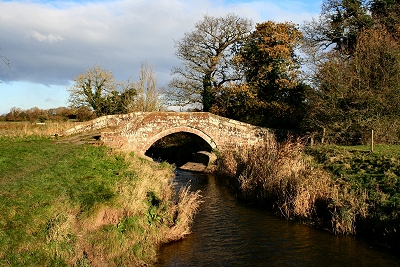 |
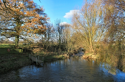
The Central Packhorse Bridge, Hockenhull Platts The central bridge crosses the River Gowy, which was lowered when the marshes were drained. |
|
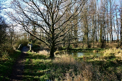 |
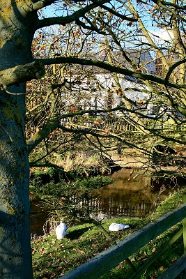
The Western Packhorse Bridge, Hockenhull Platts The packhorse bridges are part of Hockenhull Platts Nature Reserve, consisting of a water meadow, a poplar plantation, this pond and reed beds. The area, covering 11 acres (5 ha) is rich in plant and animal life. |
|
 |
Stamford Mill, Stamford Bridge Stamford Mill on the River Gowy is first recorded in a document of 1188. The mill wheel and its associated machinery were removed around 1900 when the building was converted into a house, but the remains are still visible, as is the mill pond. |
|
 |
Stamford Mill Pond, Stamford Bridge | |
 |
The Stamford Bridge Inn, Stamford Bridge This welcoming pub was established on the old Chester to Nantwich turnpike road (and the even older Roman Watling Street) next to a bridge over the River Gowy and presumably dates from that time (the latter 18th century). The bridge is now gone, but the remains can be seen from the new bridge on the main road (A51). The name Stamford comes from the Old English for stoney ford. The interior of the pub has been modernised. |
|
 |
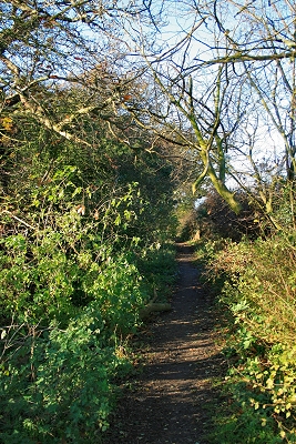
Watling Street, near Stamford Bridge The Roman road Watling Street once spanned a large part of Britain via its several branches. This branch near Tarvin lead from Chester to Northwich and on to York and Scotland. All that remains here is a pleasant rural footpath. |
|
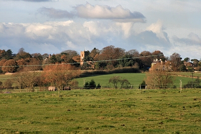 |
Great Barrow from Watling Street A distant view of Great Barrow on its ridge with St. Bartholomew's Church. |
|
 |
Great Barrow It is easy to miss the ancient centre of Great Barrow around St. Bartholomew's Church when driving through on the main road (B5132). The area has a real sense of times long past with its old buildings and lanes sunk deep into the sandstone bedrock. |
|
 |
St. Bartholomew's Church, Great Barrow There was a church here at Great Barrow in the 12th century. The present tower dates from 1744 and the chancel, the oldest part, from 1671. Much of the remainder is more recent remodelling, since by the 18th century many parts were in a poor condition. The nave and aisle were rebuilt in a matching late Perpendicular style in 1883. |
|
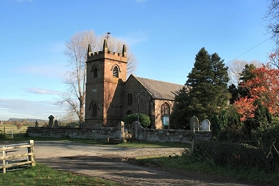 |
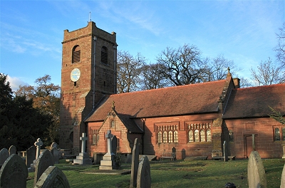
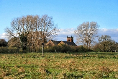
St. Peter's Church, Plemstall There are records of a church here as far back as the 7th century, when the Mersey used to flood the surrounding land and the locality (barely elevated) was known as the Isle of Chester. A legend, perhaps of the 5th or 6th century, tells of a shipwrecked fisherman who, on finding refuge here, built a church as an act of thanksgiving, dedicating it to St Peter the fisherman. Although the surrounding land has been drained, the church still stands in an amazingly isolated location. The name Plemstall or Plegmundstall ('the fenny island of Plegmund'), derives from the eponymous 9th century scholar who took refuge from the Danes as a hermit on the Isle of Chester. He became tutor to King Alfred and assisted him in the consolidation of his kingdom; he was appointed Archbishop of Canterbury in 890 and is buried in Canterbury Cathedral. There are remains of a 12th century church, but the present sandstone building is mainly 15th century. The tower was added in 1826, replacing a wooden belfry. Most of the original glass has gone, but there are fragments from the 14th century. In a display case in the north aisle are a Breeches Bible of 1608, a King James Bible of 1611, a folio edition of the bible printed by Edward Whitchurche in 1549, a black letter bible of 1549 and a King James Bible of 1623. |
|
 |
St. Peter's Church, Plemstall | |
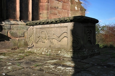 |
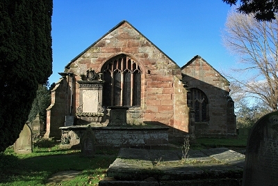
14th Century Tomb, St. Peter's Church, Plemstall This strikingly macabre 14th century tomb of the Hurleston family is located at the rear of St. Peter's church. |
|
 |
St. Peter's Church, Plemstall, from the Gowy Marshes | |
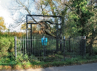 |
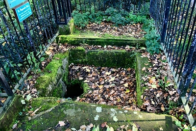
St. Plegmund's Well, Plemstall St. Plegmund's Well, near the church in Plemstall, was named after the local 9th scholar (see the article on St. Peter's church). It is one of two holy wells in West Cheshire, its first recorded mention dating from 1301. A faint inscription of 1907 on the stonework (which I couldn't discern) apparently reads: Here as in days when Alfred erst was king, baptismal water flows from Plegmund's spring. It is thought to have been used for baptisms up to the turn of the 20th century. |
|
 |
St. Plegmund's Well, Plemstall | |