|
|
|||||||||
|
|
|||||||||
Home Page: merseySights  |
Home Page: allertonOak  |
|||
 |
| CLICK A BOOTPRINT FOR A RELEVANT WALK - LINKS TO OTHER SITES AT THE BOTTOM OF THE PAGE |
 |
Tidal Channel at Heswall |  |
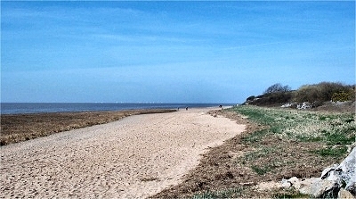 |
The Dee Shore near Heswall | |
 |
The Dee Shore at Heswall Fields The coast between Heswall and Thurstaston has a distinctly different character from that just a little further up the Dee estuary. The water comes right up at high tide and there are substantial sandstone cliffs. |
|
 |
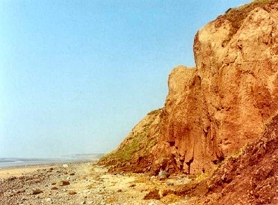
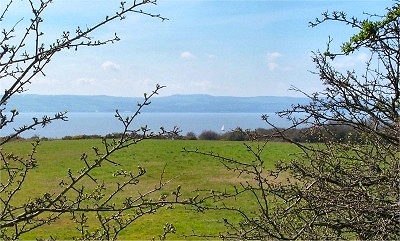
Clifftops at Heswall Fields | |
 |
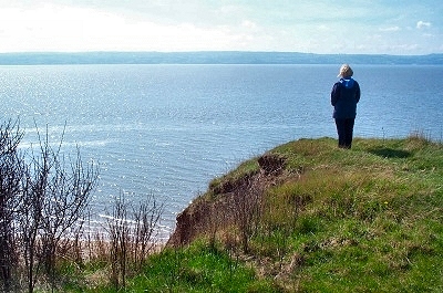
Countryside near Heswall | |
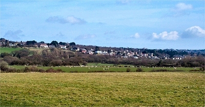 |
Heswall from The Fields The growth of Heswall dates from the early 18th century, when wealthy merchants set up holiday homes here, attracted by the scenery, fresh air and favourable climate. The construction of a railway lines between Hooton and West Kirby in 1886 (now demolished and forming the Wirral Way) and Wrexham to Bidston in 1896 (the current rail link, connecting to Liverpool), spurred further development as an up-market commuter village. Heswall includes the Wirral's highest point, Poll Hill, at 354 ft (108 m), and many parts have superb views over the Dee estuary towards Wales, especially the older part, Lower Heswall, nearer the shore. Today Heswall, including Gayton, is still one of the most sought after residential areas in the region, with prices to match. |
|
| Heswall in Lewis's Topographical Dictionary of England (1848) The parish is pleasantly situated, rising obliquely from the banks of the Dee, and commanding a fine view of that river and of the Welsh coast; it comprises by computation 3000 acres, of which 1800 are waste. The land in cultivation is chiefly arable, producing excellent crops of wheat; and the substratum abounds with red sandstone, used for building. Above the village is a fine tract of common, rising to the height of 475 feet above the level of the sea. |
||
| Gayton in Lewis's Topographical Dictionary of England (1848) William III slept at Gayton Hall, the ancient seat of the Gleggs, in June 1689, previously to embarking for Ireland. The township comprises 670 acres, of which the soil is clay and sand. There is a ferry over the Dee into Flintshire, the estuary at this place being nearly four miles broad. |
||
 |
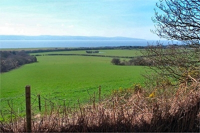
The Dungeon from Heswall Fields | |
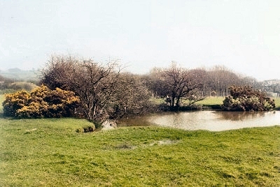 |
Pond in Heswall Fields One of a number of little ponds in the peaceful Heswall Fields area. |
|
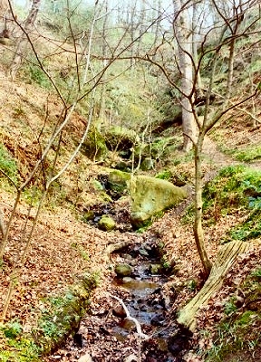 |
The Dungeon A surprisingly deep and narrow (for the area) little wooded ravine between Thurstaston and Heswall. The name is probably from the Old English dunge or denge meaning land next to the marsh. |
|
 |
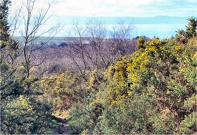
The Dee Estuary from the Dungeon | |
 |
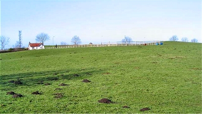
Heswall Dales, Heswall Heswall Dales is a Local Nature Reserve and a designated Site of Special Scientific Interest of 180 acres (72 ha) on the western edge of Heswall. It is an attractive sloping area of gorse and heather with birch and oak scrub from where there are superb views over the Dee estuary to the Welsh hills. |
|
 |
Heswall Dales, Heswall The Wirral Country Park Trail passes through Heswall Dales |
|
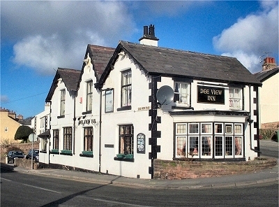 |
The Dee View Inn, Heswall It does what it says on the tin - the Dee View Inn is on Dee View Road, from where there are, wait for it, great views over the River Dee towards the hills of North Wales. |
|
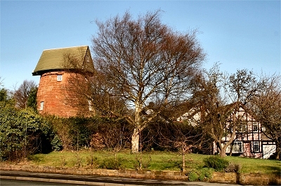 |
The Old Mill, Gayton Gayton Mill dates from around 1760, making it the oldest surviving windmill on the Wirral Peninsula. it was built of sandstone, probably from Runcorn, and once had four large sails. It last worked in 1875, when the miller was living in the adjacent cottage with his sixteen children. The sails had disappeared by 1905 due to neglect, and it continued to deteriorate until rescued by a local builder and turned into a residential property. The miller's cottage was also restored and now adjoins the windwill. |
|
 |
Cross Hill, Thingwall Thingwall is Old Norse for assembly field and the small 205 ft (63 m) high hill now known as Cross Hill was a major meeting place or parliament for Viking communities (who had begun to settle here in the early 10th century) from the entire northern half of the Wirral peninsula and possibly also from outlying areas at Helsby, Whitby and Talacre on the other side of the River Dee. In the 10th century, the area would have had complete political autonomy. The author of the famous late 14th century poem Sir Gawain and the Green Knight was probably from Cheshire. The poem is rich in Scandinavian dialect words and indicates the importance of the Viking legacy even 500 years after the first settlers. Describing the region in Arthurian times (before the Vikings) the poet talks about '[...] the wilderness of Wirral. Few dwelt there that loved either God or man with a good heart'. My thanks to www.geograph.org.uk for allowing me to use the photograph of Cross Hill. |
|
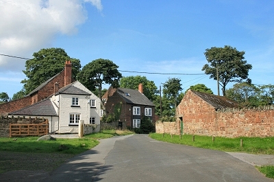 |
Landican Hamlet Landican is a nest of rural tranquility that time forgot, despite its situation close to the motorway and housing areas. |
|
| Thingwall in Lewis's Topographical Dictionary of England (1848) Thingwell [Thingwall] comprises 360 acres, the soil of which is partly clay and partly sand; it stands high, and is almost destitute of trees. The land is in general very inferior, and interspersed with large masses of red sandstone, which in many parts is quarried from the surface. |
||
| LINKS |