|
|
|||||||||
|
|
|||||||||
| Home Page: merseySights |
Home Page: allertonOak |
|||
 |
| CLICK A BOOTPRINT FOR A RELEVANT WALK - LINKS TO OTHER SITES AT THE BOTTOM OF THE PAGE |
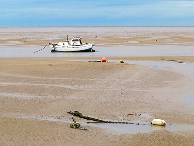 |
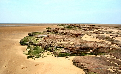
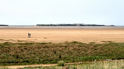
Dove
Point, Meols Meols, whose name comes from the Old Norse for sandbanks or sandhills, was a major seaport and trading post for the Viking settlers in Wirral. The coastline at Meols at this time reached significantly further out with a promontory at Dove Point that has been washed away. Major Viking archeological finds were made in the 19th century that were only revealed at exceptionally low tides. Meols was a major seaport and trading post for the Viking settlers in Wirral. Norse expeditions had started at the beginning of the 8th century, but they really took off after the unification of Norway in 872, when many nobles took issue with the King Harald I. A large number settled peacefully in the newly founded Viking kingdom of Dublin and some became Christianised by the native Irish. However they were expelled from Ireland beginning in 902 by Caerbhall, leader of the Leinster Irish, and continuing until 1014 with the Battle of Clontarf. Many of these ex-Norwegians settled finally on the Wirral, having being granted permission to do so by Edelfrida, daughter of Alfred the Great. There were many Danish Vikings in Wirral as well, as witnessed by placenames ending in -by. The Danes originally settled in East Anglia from 865 but soon moved north to Northumbria. Analysis of placenames suggests a further migration to Cumbria and south-west Scotland and from there to join the Norwegians on the Isle of Man. It is thought that the Wirral Danes arrived in quantity from there. The boundary of their dominion probably tracked the south and east edges of Tranmere, Storeton, Brimstage, Thornton Hough, Raby (boundary village in Old Norse) and Little Neston. The coastline at Meols at this time reached significantly further out with a promontory at Dove Point that has been washed away. There were major Viking archeological finds in the 19th century far out and only revealed at exceptionally low tides. My thanks to www.geograph.org.uk for allowing me to use the photograph of Dove Point. |
|
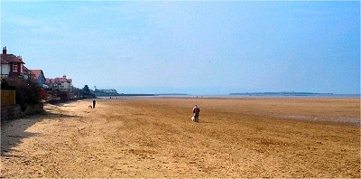 |
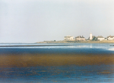
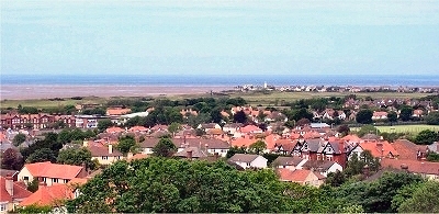
Hoylake
Shore Modern Hoylake is the union of two ancient villages: Little Meols and Hoose. Little Meols was the area near the present Hoylake railway station and Hoose was the present old village area around the Plasterer's Arms. Great Meols was the area now known simply as Meols. The name Hoylake is derived from the 'High Lake', a channel that once extended several miles along the coast from Hilbre to Dove Point at Meols. At low tide it was protected by a wide sandbank, providing a safe anchorage for ships that were too large to sail up the Dee to Chester. In the 17th Century, Hoylake was one of the main embarkation points for troops sailing to Ireland, including (in 1690) King William III and his army of 10,000. To assist shipping, two lighthouses were built around 1760, both rebuilt in the 1860s. By the 1830s, the cutting of a new channel to Liverpool marked the end of Hoylake's relevance for shipping and the focus shifted to fishing. Gradually, the more affluent took an interest in Hoylake, attracted by its fine beaches and opportunties for the newly fashionable sea-bathing. The arrival of the railway in 1886 caused a rapid expansion of the population and the growth of the town both as a resort and as a commuter base. Today, Hoylake is perhaps most famous for the Royal Liverpool Golf Course, originally a nine-hole course founded by local enthusiasts in 1869. |
|
| Great Meols in Lewis's
Topographical Dictionary of England (1848) A part of it, which fronts the Irish Sea for upwards of two miles, consists of a narrow slip of sandhills, protected in some instances by embankments from the inundations of the sea: as it approaches Hoose, the slip widens, and becomes connected with that township. |
||
| Hoose in Lewis's
Topographical Dictionary of England (1848) This township, which comprises only 74 acres, of a sandy soil, is not mentioned in the Domesday survey; which may be attributed to its being so small, and lying between Great and Little Meolse, of which it was probably then a part. [...] The sea front of the three townships occupies a line of upwards of five miles, reaching from the western part of Wallasey to the village of West Kirby. The inhabitants of Hoose are principally boatmen and fishermen, who have frequently evinced the greatest courage and alacrity in rescuing mariners from the horrors of shipwreck; large banks of sand, extending for miles on the northwest, being annually the scene of most fatal disasters to shipping. |
||
| Little Meols in Lewis's
Topographical Dictionary of England (1848) The greater part was a waste, until Lord Stanley of Alderley granted a building-lease for a term of eighty years, which has led to the erection of several pleasing villas. These, for summer residences and the convenience of excellent sea-bathing, notwithstanding the apparent want of attraction from their being seated amid sandhills on the desolate extremity of a mere promontory, are in great request, and a considerable increase may be anticipated in their number. In this township and Hoose is Hoylake, where his lordship's father erected, on the margin of the sea, one of the most spacious hotels in the county, now much frequented during the bathing season. A little to the north is a smaller hotel. A commodious church, also, has been erected by the lady of Mr. Swainson, which affords great accommodation to the inhabitants and the numerous visiters attracted hither, who before had no place of worship nearer than the parish church; it is dedicated to the Holy Trinity, and is a neat edifice in the Norman style, from designs by Mr. Picton, of Liverpool. |
||
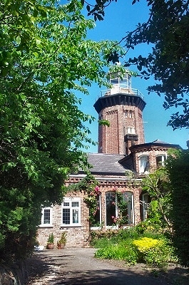 |
Hoylake
Lighthouse, Hoylake Hoylake Upper Lighthouse was first established here in 1764, when, together with the Lower Lighthouse and the two Leasowe lighthouses (only one extant), it was one of the four Leading Lights for guiding shipping into the Mersey estuary. The lights were used for alignment purposes and the Lower Lighthouse was actually movable in order to adjust to the shifting sand banks. Both lighthouses were demolished in 1865 and rebuilt. The Upper Lighthouse remains on Valentia Road. It is an octagonal brick building that was decommissioned in 1886 and is now part of a private house incorporating the former lighthouse keepers' quarters. The Lower Lighthouse was a similar structure on the shore on what is now North Parade, alongside the lifeboat house (now the Lifeboat Museum) and the coastguard station. It became disused as such in 1908 and was demolished in 1922. |
|
 |
Red
Rocks, Hoylake These isolated rocks off Hilbre Point (submerged at high tide) form part of the Red Rocks Site of Special Scientific Interest. Red Rocks themselves are an important site for migrant birds, over 200 species having been recorded here. |
|
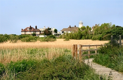 |
Boardwalk, Hilbre Point, Hoylake | |
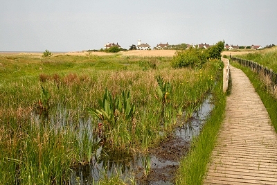 |
Red
Rocks Marsh Red Rocks Marsh is part of the Site of Special Scientific Interest. It is an area of sand dunes, dune slacks (ponds), reedbeds and marsh, important for many species of wintering birds. The open pools are the only area in the Wirral that provide a habitat for the rare natterjack toad. |
|
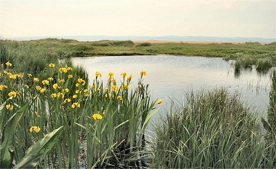 |
Pond in Red Rocks Marsh | |
 |
Hilbre Island from Red Rocks Marsh | |
 |
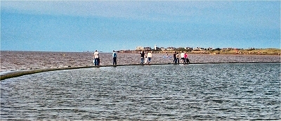
Hilbre
Point, Hoylake This is the extreme north-west corner of the Wirral mainland, seen across the West Kirby shore at low tide with the Irish Sea beyond. |
|
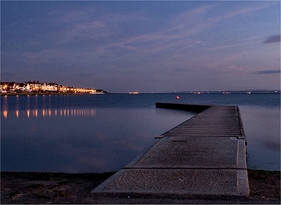 |
West
Kirby at Night Thanks to Dave Steel for this photo. |
|
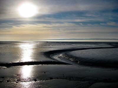 |
Low
Tide at West Kirby Thanks to Paul Scales for this photo. |
|
 |
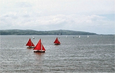
The
Marine Lake, West Kirby At high tide on the sea wall of the marine lake you can seem to be walking on water. |
|
 |
The Dee Estuary at Cubbins Green, West Kirby | |
 |
The War Memorial, Grange Hill, West Kirby | |
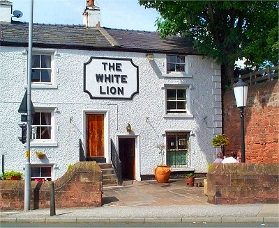 |
The
White Lion, West Kirby This old pub on Grange Road has bags of character. Inside is a maze of cosy small rooms, only partially knocked through, with walls constructed of massive bare sandstone blocks. Situated on the edge of Grange Hill, it almost seems to grow out of the bedrock. |
|
 |
West Kirby and Hilbre Point from Grange Hill | |
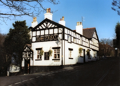 |
The
Ring O'Bells, West Kirby The Ring O'Bells was rebuilt in 1810 on the site of an older pub of the same name. The name presumably comes from the nearby St. Bridget's Church that has its origins in Norman times. The cellars are apparently cut into sandstone and extend underneath the road, where the rock has been shaped to hold barrels of ale with a drainage channel below. The pub is in Village Road, an area of West Kirby that seems untouched by the centuries. |
|
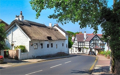 |
West
Kirby Old Village West Kirby, in common with much of the Wirral, was occupied by Christianised Vikings from Ireland. The other Kirby was then Kirby in Walea to the east, now known as Wallasey. The original settlement was around here in the old village. For many centuries, West Kirby was a small agricultural community, but the arrival of the railway in 1886 changed all that and by 1900 the population was 11000, many commuting into Liverpool to work. From about this time, West Kirby also developed as a resort for holidaymakers and day-trippers, the latter still very much in evidence. |
|
| West Kirby in Lewis's
Topographical Dictionary of England (1848) It is bounded on the north by the Irish Sea, and on the west by the estuary of the Dee; and from some rising ground about a quarter of a mile from the shore, extensive views are obtained of the Irish Sea, the river Dee, and the Flintshire and Carnarvonshire hills. The quality of the soil varies materially in different parts. In the townships on the sea-shore it is very light and sandy, and, being in a great measure sheltered by hills from the easterly winds, is particularly suited for the growth of early potatoes, for which the district has long been celebrated. Some extensive commons are yet unenclosed, and much even of the best land in the parish affords scope for improvement. |
||
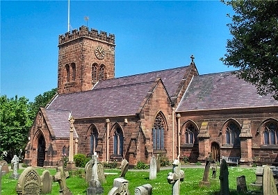 |
St.
Bridget's Church, West Kirby Although much altered over the centuries, the oldest identifiable parts of St. Bridget's church are parts of the chancel, vestry, east bay and north aisle, dating from around 1320. The present tower was built in 1493. A major restoration (almost a rebuilding) was undertaken in 1869-70. A church had been founded on this site by the Vikings in the 10 century. The name Kirby is Old Norse for village of the church. St. Brigit of Kildare (ca. 451 - 525) is one of Ireland's patron saints. |
|
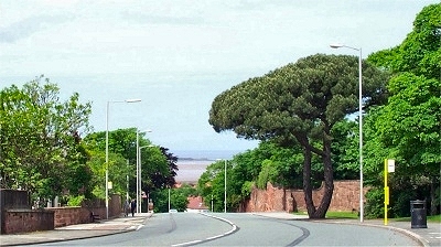 |
Grange
Road, West Kirby This is the first view of West Kirby when driving in from the south - a sudden enticing glimpse of the sea and Hilbre Island. The fine tree on the right is an Umbrella Pine, a native of southern Europe famous for its edible pine nuts but rare at these latitudes. It was once located in a private garden before the new road took priority. |
|
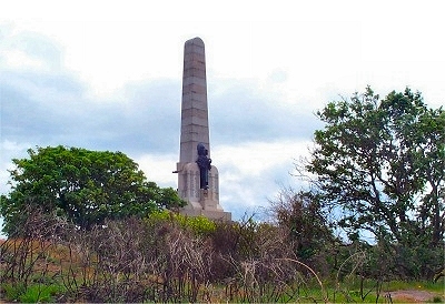
| The
Beacon, Caldy Hill, West Kirby The Beacon stands on the site of an old mill that was used as a landmark by mariners navigating into the River Mersey. It was destroyed in a storm in 1839 and the present 60ft (18m) column was erected in 1841 by the trustees of the Liverpool Docks by permission of the landowner John Shaw Leigh, who also gave the stone for its construction. |
||
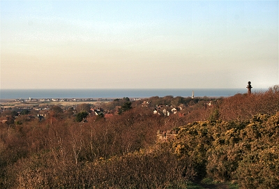
| The Dee Estuary from the Beacon, West Kirby | ||
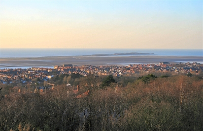 |
West Kirby and Hilbre Island from Caldy Hill | |
 |
Grange Hill from Caldy Hill | |
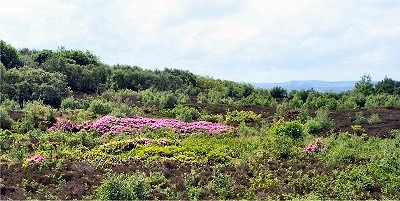 |
Caldy
Hill Heathland Caldy Hill is a Site of Biological Importance as a lowland heath habitat for, among others, common lizards, grass snakes and adders. It is a lovely area for walks, criss-crossed with trails where you can find peace and quiet with fine views. |
|
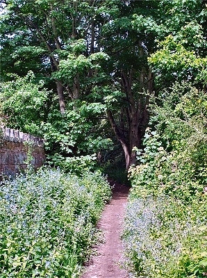 |
Fleck
Lane, Caldy Fleck Lane is a picturesque path that runs dowm Caldy Hill between old boundary walls. |
|
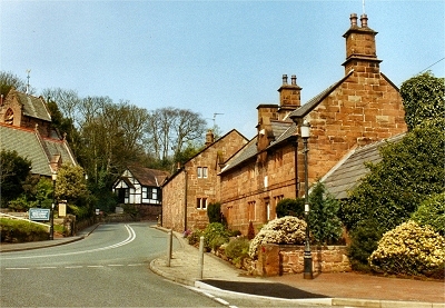 |
Caldy
Village The village was bought and renovated by R.W. Barton, a Manchester businessman, in 1832. There is real old world charm here. The lovely old cottages, some in sandstone and some in mock Tudor style, date from around 1700 and were originally farm buildings. The surrounding residential area is of a kind often referred to by estate agents as 'much sought after', though I doubt there are that many people with the wherewithal for the 7 figure price tags. |
|
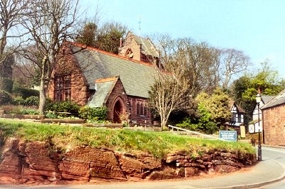 |
The
Church of the Resurrection and All Saints, Caldy The church, originally a school, along with the manor house behind it, was built in 1868 as part of R.W. Barton's redevelopment of the village. It was in use as a chapel from 1882 and, following extensive alteration, was consecrated under its present name in 1907. |
|
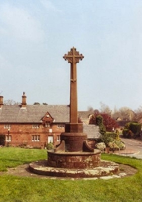 |
The Village Cross, Caldy | |
| LINKS |
| Dee Estuary at wirral.gov.uk |
| Hoylake Lifeboat website |
| History of West Kirby at hoylakeandwestkirby.com |
| St. Bridget's Church website |
| Hoylake news views and more at Hoylake Junction |