Early Maps
A History of Allerton and Mossley Hill @ allertonOak  
 
A History of Allerton and Mossley Hill home page
allertonOak home page
The Yates and Perry Map of 1768
Key:
1 Woolton Road
2 Beech Lane (later Menlove Avenue)
3 Allerton Lane (later Calderstones Road)
4 Yew Tree Road
5 Dowsefield Lane
6 Woolton Road (originally part of Allerton Road)
7 Allerton Road
8 Green Lane
9 Harthill Road
10 Greenhill Road
11 Heath Road
12 Smithdown Lane (later Smithdown Road)
13 Greenbank Road
14 Greenbank Lane
15 Penny Lane
16 Rose Lane
17 Mossley Hill Road (originally partly Outacre Lane)
18 Elmswood Road
19 Woodlands Road
20 Sudley Road
21 Barkhill Road
Allerton and Mossley Hill in the Yates and Perry Map of 1768
Hill House (Fletcher's Farm)
Heath Cottage
The earliest general map covering Allerton and Mossley Hill is that of Yates and Perry entitled A Map of the Environs of Leverpool drawn from an Actual Survey taken in the Year 1768 by Wm. Yates and Geo. Perry. For the first time we see the old roads and residences of the area. At the bottom of this page I have transcribed the contents of this map onto a modern map.
Between Woolton and Beech Lane once stood Dodlow Hall, which gave its name to the current Dudlow Lane. On Calderstones Road were the Calderstones in their essentially original position at the end of what is now Druids Cross Road. Hunt's Folly was some form of monument connected with the hunting that once took place in this area (cf. the neighbouring district of Hunts Cross). Dowes (later Douse House) survives only as Dowsefield Lane. Hill House was the original name of Fletcher's Farm (1740). Allerton Hall can be seen with its original tree-lined avenues, the longest leading to the obelisk by the ruins of the house since known as Allerton.
The area called Dry Soil seems to be the triangle on which All Hallows Church now stands. Nearby Hillpit House (1650) later became known as The Forty Pits. Off Heath Road, though not named on this map, is shown Heath Cottage (17th century). Both still stand. Lawtons on Greenhill Road and Cob Hall (presumably named after the building material employed) on Rose Lane have vanished without trace. Green Bank (early 18th century) on Greenbank Lane is still there. Mosley Hill, which probably gave its name to the district, burned down in 1891.
The Obelisk
Sherriff's Map of 1823
Key:
1 Woolton Road
2 Beech Lane (later Menlove Avenue)
4 Yew Tree Road
6 Woolton Road (originally part of Allerton Road)
7 Allerton Road
8 Green Lane
9 Harthill Road
10 Greenhill Road
11 Heath Road
12 Smithdown Lane (later Smithdown Road)
13 Greenbank Road
14 Greenbank Lane
15 Penny Lane
16 Rose Lane
17 Mossley Hill Road (originally partly Outacre Lane)
18 Elmswood Road
19 Woodlands Road
20 Sudley Road
21 Barkhill Road
22 Dudlow Lane
23 Cinder Lane
24 Crompton's Lane
25 Hornby Lane
26 Gipsy Lane
27 Road alongside the golf course
28 Road alongside Allerton Tower
29 Later Pitville Avenue
Allerton and Mossley Hill in Sherriff's Map of 1823
Savages Common (Camp Hill)
Oak Farm
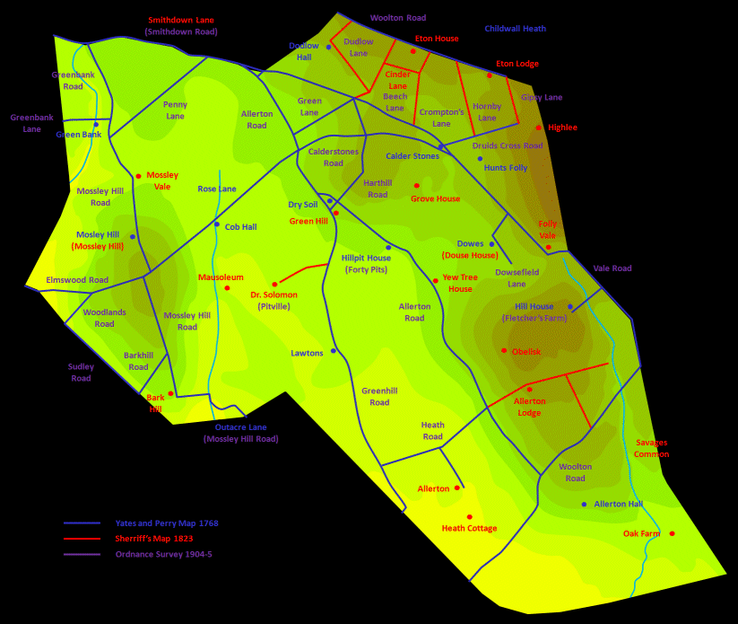
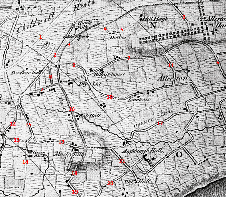
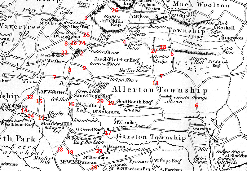
Significantly later than the Yates and Perry map is Sherriff's Map of the Environs of Liverpool of 1823. This provides interesting further detail of the old roads and, especially, of prominent residents, who would be either farmers or well-off professionals. Allerton Lane and Dowsefield Lane do not seem to be there, but the remainder of the key to the Yates and Perry map applies here, with new entries below. At the bottom of this page I have transcribed the contents of this map onto a modern map.
Several Roads between Woolton Road and Beech Lane (Menlove Avenue) are newly included. Crompton's Lane is seen to be named after the local resident Dr. Crompton, who lived at Eton House (1776). Further along, Eton Lodge and Highlee have disappeared. On Beech Lane, Folly Vale, named after Hunt's Folly that was once situated nearby, stood roughly where Mendips stands now, but the road peters out at Savages Common (Camp Hill) and Oak Farm (17th century). The roads alongside what are now the Allerton Golf Course and Allerton Tower Park were never redeveloped and today give a feeling for what many of these old lanes might have looked like.
Ivy House on Allerton Road, two houses called Green Hill and Yew Tree (perhaps giving its name to the road) have disappeared. The property called Grove House was later demolished to build the 
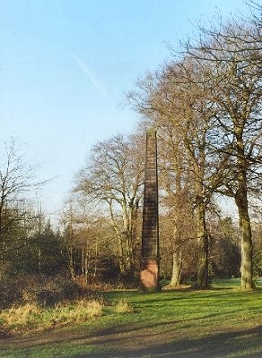
mansion called Calderstone. Dr. Solomon, who gave his name to Solomon's Brook, is revealed as a local inhabitant. Nearby was his mausoleum that disappeared with the advent of the railway. Heath Cottage is now named as such.
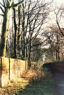
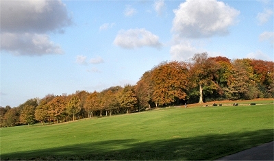
Ancient road by Allerton Tower
Contemporary Map
The map here shows the relevant details from the two older maps projected onto a modern map with north at the top. Unsurprisingly, the original surveys were not particularly accurate. Newly added here are the roads and properties named in the 1904-5 Ordnance Survey. Some of these names will, nonetheless, have been around for centuries.
It is interesting and rather pleasant to wander around these roads and imagine them as the country lanes they once were. A number of the original buildings are still standing and the roads are often leafy and bounded by the original sandstone walling.
 
A secluded section of Allerton Road
 
Acknowledgements and Further Reading
Careful study of the old Ordnance Survey maps at www.old-maps.co.uk is rewarding. Hard copies of the 1904-5 Ordnance Survey maps of the area are available for purchase at The Godfrey Edition.
This is a non-commercial website that is intended entirely for research and educational purposes. If I have unintentionally breached copyright with any images, I hope that the copyright owner will tolerate my usage in the present context, otherwise I will remove the material. Modern colour photographs are by the author.