| The Calderstones |
| The burial
chamber with its mound seems to have been fairly
intact at the time of the 1568 survey. Just three
stones are described as visible above the earth.
The appearance was similar in 1700, when there
was another boundary dispute. By about 1765, the
mound had been disturbed and a number of urns
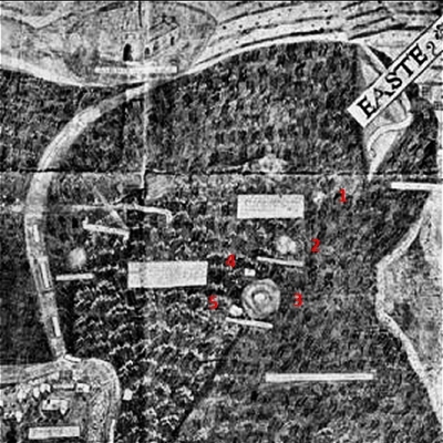
removed. The Calderstones appear on the Yates
and Perry map of
1768, but by 1800 the site had been partially
destroyed, a process completed by about 1833,
when Beech Lane was widened. The following entry
in Baines's Directory of 1825 is interesting: |
| |
Close by the farm on
which the famous Allerton oak stands, and just at
the point where four ways meet, are a quantity of
remains called Calder stones [...]. From the
circumstance that in digging about them urns made
of the coarsest clay [and] containing human dust
and bones have been discovered, there is reason
to believe that they indicate an ancient burying
place [...]. Some of the urns were dug up about
sixty years ago, and were in the possession of
Mr. Mercer of Allerton. |
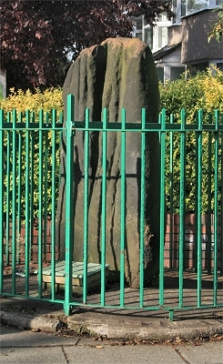
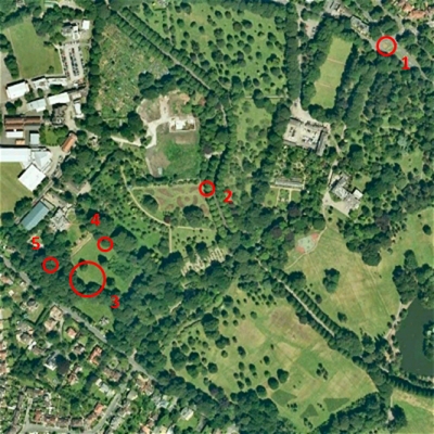
| An engraving
of the time shows the scene with Childwall Hall
in the background (top right). In 1845 the
resident of Calderstone House, Joseph Walker, was having his
lodge and drive built and had the stones arranged
in a circle and enclosed in a wall (still there
at the junction of Calderstones Road and Menlove
Avenue) with railings. It is thought that they
had not been moved far from their original
position as the surrounding network of roads is
ancient. The arrangement of the stones was based
upon the belief then current that they were the
remains of a Druidical stone circle. John Peers,
a local gardener recalled the early 1800s: |
| |
[I] remembered the
Calderstones well, before they were set up in
their present position. The roads at that time
were narrow country lanes. At this place there
are four cross roads, and the stones lay upon a
large mound at the roadside, high above the road,
on [...] the south side. Only a few of the larger
stones could be seen lying flat near the top,
partly buried in the earth, and a few of the
points of the other stones. Upon this mound, in
the summer, after work, and on Sundays, the boys
and men from the neighbouring farms would come
and lie in the sun. [..] [I] well remembered the
mound being destroyed. They were widening the
road about the time it was done away with. When
they dug down into it they found more of the
stones, and the marked ones were among them. For
some time the stones were laid aside on the farm,
and afterwards some of the gentlemen of the
neighbourhood had those now standing set up;
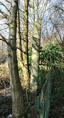
others were taken away. Mr. Booker had the
largest and set it up in his field, where it now
is for the cattle to rub on. He thought that
there were two more large stones. but did not
remember what became of them. When the stones
were dug down to, they seemed rather tumbled
about in the mound. They looked as if they had
been a little hut or cellar. Below the stones was
found a large quantity of burnt bones, white and
in small pieces. He thought there must have been
a cart-load or two. |
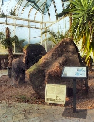
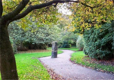
| Mr. Booker's stone was probably not the
Robin Hood Stone, tempting though that sounds.
The Calderstones were left to the weather and
industrial pollution on Walker's site until 1954,
when Liverpool Corporation removed them for
cleaning and restoration. In 1964 they were
erected randomly in their present location in the
Botanical Gardens vestibule in Calderstones
Park. |
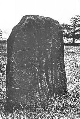
| There remain
six irregular sandstone monoliths of different
sizes with a variety of markings: spirals,
concentric circles, arcs, cup marks, cup and ring
marks and footprints. Several of these styles of
carving are similar to examples found in burial
chambers in Ireland and Anglesey, indicating the
possibility of cultural influences spreading here
from Ireland via North Wales about 4,000 years
ago. Others markings may be graffiti from the
last 200-500 years. Footprint marks are more
unusual and perhaps indicate influences from
Brittany and elsewhere. Because of their
decorations, these stones may have been the walls
of the burial chamber, the others having been
appropriated by local people over the years. |
|
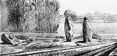 |
| The
Calderstones in 1825 by William Lathom |
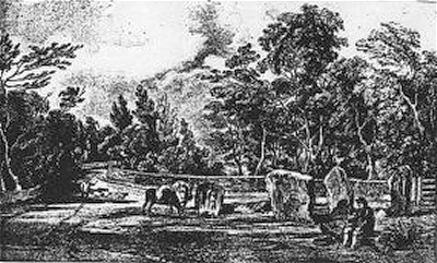 |
| The
Calderstones c.1840 |
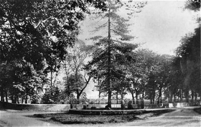 |
| The
Calderstones c.1900 |
|