 |
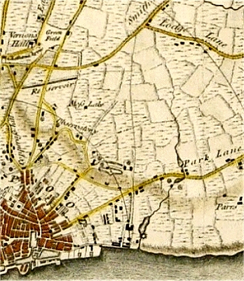
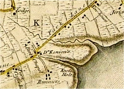
| The
Dingle and Dickenson's Dingle on the Yates and
Perry Map ... |
| |
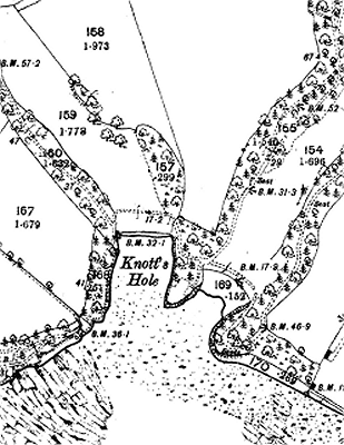 |
| Knott's
Hole and environs in 1893 |
| |
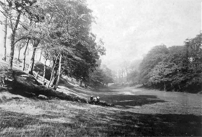 |
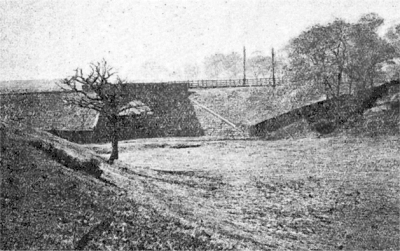
| The
Dingle c.1900 |
| |
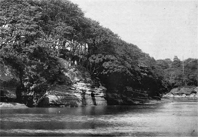 |
| Dingle
Point and Knott's Hole c.1900 |
|
| The Dingle Brook and
Knott's Hole |
| After
The Pool, probably the most
famous of Liverpool's lost rivers was the
Dingle Brook with its outlet near Knott's
Hole. It gave its name to the adjacent
district and, along with the surrounding wooded
dell (The Dingle), the area was a famous
local beauty spot for centuries. Knott's hole
also provided an occasional sheltered landing
place for crossing the Mersey when rough weather
prevented the use of the Pier Head. |
| The
source of the Dingle Brook was close to the Ancient
Chapel of Toxteth on Dingle Lane and Park
Road. It may have been a bit further north - the
Yates and Perry map is not very clear. It ran
through the grounds of the Turner Home
and the allotments to emerge into the Mersey
slightly inland from the current roundabout on
Riverside Drive and Promenade Gardens. |
| In the first
half of the 1800s, the area was occupied by
wealthy merchants with their grandiose mansions.
At this time, Smith's Stranger's Guide to
Liverpool by Alexdander Brown (1843) records
that: |
| |
The Dingle is a
sweet romantic dell, in the neighbourhood of
[Prince's Park], and is the property of Joseph
Brooks Yates Esq., who in the most generous
manner opens it to the public on Wednesdays and
Thursdays [...] during the summer [known locally
as 'Dingle Days']. It is a delightful retreat,
extending to the river, having all the diversity
of hill and dale, wood and grove, tastefully laid
out in shady and winding walks, with numerous
arbours and rustic seats. Few persons in
Liverpool are aware of the beauty of this
romantic spot [...]. Admission is gratuitous,
visitors only being required to enter their names
in a book at the lodge, to prevent improper
persons gaining access to the ground. |
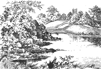
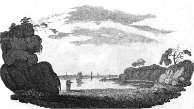
| The
Ordnance Survey map of 1893 makes it clear that
the area described as 'Knots Hole' on the Yates
and Perry map was actually two little rocky coves
separated by the headland known as David's
Throne. Dingle Brook emptied into the
southerly one of these, the other being Knott's
Hole proper. To the north was Dingle Point
and nearby a cave known as Adam's Buttery.
A drawing of about 1800 (see on the right) well
captures this beauty spot. It depicts the idyllic
tree-lined rocky coves looking west over the
Mersey past Dingle Point towards the rural hills
of Wirral. By 1907, Robert Griffiths could still
write in The History of King John's Royal
& Ancient Park of Toxteth: |
| |
[...] one is
confronted with one of the most beautiful glens
in this part of the country. [...] On either side
the verdure-clad embankments rise to a height
over-capping some of the hoary trees with which
the the whole of the slopes are covered.
[...] The deep solitude is broken only by the
gentle murmur of the Mersey water, the joyous
note of the feathered songsters, secure in their
lofty homes, or the whirr of the martin’s
wing as it hastily rises from its covert amid a
little cloud of summer dust at the unusual sound
of a stranger’s footfall. |
| However,
by 1859 the stream was already drying up because
of building higher up, and some rather pretty
verses penned by William Roscoe entitled The
Nymph of the Dingle bemourn this fact. In
1919 the whole estate was bought by the Mersey
Docks and Harbour Board and redeveloped as oil
jetties and storage tanks. The upper part of the
dell was filled in for allotments shortly after.
In the 1930s, a wall was built across the shore
and the area used as a rubbish dump. After World
War II the rest of the bay was filled in with
building rubble from bomb damage, subsequently
covered over by landfill waste dumping. The
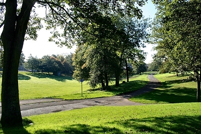
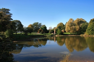
landscape was reshaped into gardens in 1984 for
the International Garden Festival, for
which a partial restoration is being planned at
the time of writing. |
|
 |
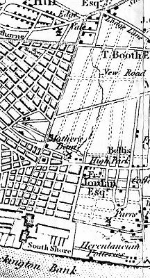
| ...
and on Sherriff's Map |
| |
 |
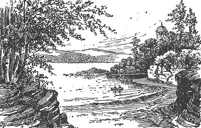
| The
Dingle Outlet, David's Throne, Knott's Hole and
Dingle Point in the 18th century |
| |
 |
| The
Dingle Outlet, David's Throne, Knott's Hole and
Dingle Point c.1800 |
| |
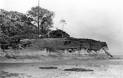 |
| Knott's
Hole and David's Throne c.1890 |
| |
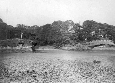 |
| The
Dingle outlet with David's Throne (left) c.1900. |
|