| Countryside |
| From the
time of the Anglo Saxons to the early 19th
century, the landscape remained essentially
unchanged: a mix of farms, crop fields and
pastures, wooded higher ground and quiet country
lanes. As we have already noted, the Anglo-Saxon
placenames in the area provide a clue as to the
nature of the landscape over 1000 years ago: place
of oaks, alder-tree settlement, grassy
settlement, goat field, wood by
a slope, oak tree by water, brushwood,
wavering tree. Later on the old byways
had aquired names like Beech Lane, Elmswood
Road, Green Lane, Greenhill
Road, Heath Lane, Rose Lane
and Woodland Road. Allerton appears in
the Domesday Book of 1086 as Alretune.
Sometime, traditionally
during the 11th century but probably several
centuries later, an oak sapling appeared in
Allerton and the tree is still with us: the Allerton
Oak. By the 13th century, the adjoining
region to the north-west was King John's hunting
domain, Toxteth Park. The modern name Allerton
first appeared in 1306. |
| By 1801 the
population of Allerton was only 178. In his book
of 1820, A Journal of Travels in England,
Holland and Scotland and of two Passages over the
Atlantic in the Years 1805 and 1806,
Benjamin Silliman, describing a visit to William Roscoe at Allerton Hall, writes |
| |
Our road to Allerton
Hall was through a most delightful country. The
river Mersey was on our right, and the fields
sloped with gentle declivity to its banks. The
county of Cheshire was extensively in view over
the river, and beyond that, Wales with its rude
mountains. |
| At the time
he made his visit, he would probably have passed
along a tree-lined avenue that then stretched
from the obelisk by Allerton Manor all the way to his destination at
Allerton Hall. By 1841 the population of Allerton
had risen to 443. In 1848, Lewis's
Topographical Dictionary of England records: |
| |
Allerton, a
township, in the parish of Childwall, [...]
containing in 1846 about 800 inhabitants. The
township comprises 1531 acres, and consists
partly of a luxuriant vale, and partly of gently
rising hills, which command fine views of the
river Mersey at its widest part, with portions of
Cheshire and North Wales. The air is salubrious,
and the scenery adorned with wood; the soil is of
various quality, in some parts sandy, and in
others a stiff clay. [...] There is a quarry of
red sandstone. |
| The quarry
referred to was either the one at the bottom of
Crompton's Lane or one by Quarry Bank. Neither
survive. There would have been a few other grand
houses, such as Allerton Priory, Sudley, Calderstone and Green Bank, in the area by that time. The
precursor of the London
and North Western Railway, along with its Allerton
and Mossley Hill stations, had appeared by the
time of the 1850 Ordnance Survey. It is not quite
clear when the name Mossley Hill first
turned up, though it is of much more recent
origin than the name Allerton and
clearly has descriptive connotations. The Yates
and Perry map of
1762 shows a house called Mosley Hill;
it was probably demolished in the late 18th
century and is now the site of the university
halls of residence. Sometime between the 1850 and
1894 Ordnance Surveys, the name transferred to
the whole district, though maybe nearer the
earlier date as Mossley Hill Station
appears as such on the earlier map. |
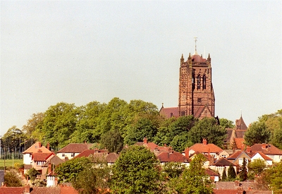
| The 1870s
saw the construction of the two magnificent
churches of St. Matthew and St. James in Mossley Hill and All Hallows in Allerton. By the late 19th
century, many wealthy professionals had chosen to
build their mansions on the higher and more
wooded ground of Allerton and Mossley Hill. Greenbank
Park was
purchased for the public by Liverpool Corporation
in the 1890s. By the early 1900s, suburban
encroachment into the north of Mossley Hill was
just beginning and Calderstones
Park had been
purchased by Liverpool Corporation. In 1907 the Victoria
History of the County of Lancaster tells us
that: |
| |
Allerton is a
suburban township containing 1,586 acres
pleasantly situated on the gentle slopes of a
ridge which rises on the eastern side to 230 feet
above sea level, overlooking the River Mersey
across the adjacent township of Garston. There
are several large residences with their private
grounds set in the midst of pastures and a few
arable fields. There are plantations of trees,
some of a fair size for a suburban district. An
air of tidiness reigns over what remains of the
natural features, with neatly-kept hedges and
railed-in paddocks, and shrubs grown to rule and
measure. The roads are good, and the soil,
apparently clay and sand, appears fertile, and is
of course much cultivated; good cereals are
successfully grown. The pebble beds of the Bunter
Series of the new red sandstone or trias underlie
the entire township. |
| The same
source informs us that at that time the local
pronunciation of Allerton was Ollerton.
In the same year, Dixon Scott, in his book Liverpool,
has this to say about Mossley Hill: |
| |
[In Mossley Hill ]
grave roads, filled with that indescribable
hushed exclusiveness which only tall, ripe,
sandstone walls and overarching leafage have
power to confer, lead up the hill towards the
Church. There are deliberate lodges and sudden
glimpses of deep-breathing lawn; life grows
leisurely and communicative; the silence is full
of confessions. The Church itself, bulking
monumentally against the sky, continues the warm,
grave intimacy: even the green stillness that
encircles it seems fuller of humanity than all
the acres, dense with flesh and blood, over at
Everton and Anfield. It is always worth while,
therefore, to step through to the farther wall.
There, in a flash, you find you have come again
to the uttermost edge of the town. A great
landscape leaps suddenly out from beneath your
feet, woods curve distantly about it, sweet airs
bring a company of quiet sounds. |
| Well, it
doesn't get much better than that, does it? I
have to say that, despite the purple prose, his
description of this particular part of Mossley
Hill still holds good if you can find a lull in
the traffic on Rose Lane. The 'great landscape'
he talks about is the view over Allerton to the
east and south-east. |
|
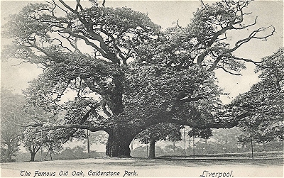 |
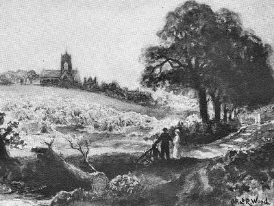
| The
Allerton Oak c.1900 |
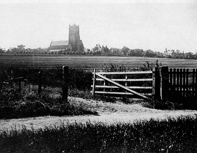 |
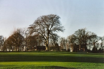
| Fields
near Mossley Hill Church c.1898 |
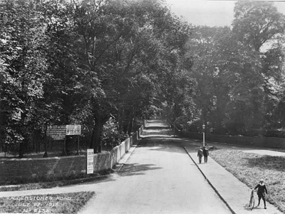 |
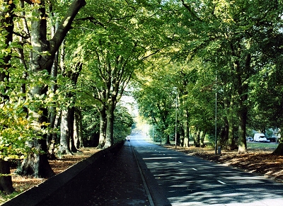
| Calderstones
Road in 1918 |
|