| Road Names and their
Origins |
| Abbotshey Avenue and
similar |
The farm called Abbot's
Heys. |
| Allerton Beeches |
The house called Allerton
Beeches. |
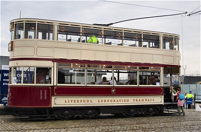
| Allerton Road and
similar |
The historical road
through Allerton |
| Archerfield Road |
After the Robin
Hood Stone,
thought to have been used to sharpen arrows in a
field used for archery practice. |
| Barkhill Road |
The house called Bark Hill. |
| Beaconsfield Road |
The house called Beaconsfield
in Woolton, after the beacon on Woolton Hill. |
| Booker Avenue |
The merchant Josias Booker. |
| Brocklebank Lane |
Thomas Brocklebank of the famous shipping family,
who lived at Springwood. |
| Brodie Avenue |
Liverpool City Engineer John
Alexander Brodie. |
| Calderstones Road and
similar |
After the neolithic Calderstones. |
| Carnatic Road |
After Carnatic House. |
| Cinder Lane |
Until the 1950s, cinders
were used as a rudimentary road covering. |
| Cleveley Road |
The house called Cleveley. |
| Cooper Avenue |
Alderman Joseph Cooper,
an ironmonger of Oak House, Aigburth
Hall Avenue. |
| Crompton's Lane |
After Dr. Peter Crompton of Eton house. |
| Dowsefield Lane |
After the ancient Douse
[sic.] House. |
| Druids Cross Road and
similar |
The house called Druids
Cross, after the
once supposed druidical associations of the
Calderstones. |
| Dudlow Lane and similar |
After the ancient Dodlow
[sic.] Hall. |
| Elm Hall Drive and
similar |
The house called Elm
Hall. |
| Elmsley road |
The house called Elmsley. |
| Elmswood Road |
The house called Elmswood
Hall. |
| Glendyke Road and
similar |
Presumably connected
with the local feature called The Forty Pits. |
| Green Lane |
A historical, presumably
rural, road. |
| Greenbank Lane and
similar |
The house called Green Bank. |
| Greenhill Road and
similar |
The house called Green
Hill. |
| Greenwood Road |
Associated with the Robin
Hood Stone. |
| Harthill Road and
similar |
The house called Hart
Hill. |
| Heath Road |
From the original Garston
Heath. |
| Hillfoot Road |
At the foot of Camp
Hill. |
| Hillside Road |
The house called Hillside
House. |
| Holmefield Road |
The house called Holmefield. |
| Hornby Lane |
Merchant Joseph Hornby,
who lived at Druids
Cross. |
| Kelton Grove |
The house called Kelton. |
| Mather Avenue |
Solicitor Arthur Stanley
Mather, Mayor of Liverpool 1915-16. |
| Menlove Avenue and
similar |
Alderman Thomas Menlove
(1840-1913), a draper and chairman of the Health
Committee. |
| Melbreck Road |
The house called Melbreck. |
| Mossley Hill Road and
similar |
After the ancient house
called Mosley [sic.] Hill. |
| Netherton Road |
The house called Netherton. |
| Park Avenue |
The road to Sefton Park |
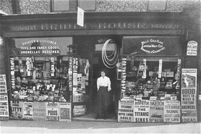
| Penny Lane |
A historical road and
presumably a historical name, which occurs
elsewhere, but the origin is unknown to me. |
| Pitville Avenue and
similar |
The farm called Pitville,
which seems to have had marl pits by it. |
| Queens Drive |
After Queen Victoria |
| Rose Lane |
A historical road that
presumably had wild roses in the hedgerows. |
| Rosemont Road |
The house called Rosemont, after Rose Lane and Mossley
Hill. |
| Smithdown Road |
From the Anglo-Saxon Esmedune,
after a lost village of that name mentioned in
the Domesday Book. |
| Springwood Avenue |
The house called Springwood. |
| Sudley Road |
The house called Sudley. |
| The Vineries |
The house called The
Vineries. |
| Vale Road |
In the valley between
Allerton and Woolton Hill. |
| Vicarage Close |
Once the location of
Allerton Vicarage serving All Hallows Church. |
| Woolton Road |
The historical road to
Woolton. |
| Yew Tree Road |
The house called Yew
Tree House. |